
IMAGES TAKEN NEAR TO
Bertha Park View, PERTH, PH1 3JE
Introduction
This page details the photographs taken nearby to Bertha Park View, PH1 3JE by members of the Geograph project.
The Geograph project started in 2005 with the aim of publishing, organising and preserving representative images for every square kilometre of Great Britain, Ireland and the Isle of Man.

There are currently over 7.5m images from over14,400 individuals and you can help contribute to the project by visiting https://www.geograph.org.uk
Image Map
Images are licensed for reuse under creativecommons.org/licenses/by-sa/2.0
Notes
- Clicking on the map will re-center to the selected point.
- The higher the marker number, the further away the image location is from the centre of the postcode.
Image Listing (7 Images Found)
Images are licensed for reuse under creativecommons.org/licenses/by-sa/2.0
Image
Details
Distance
1
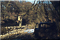
River Almond near Ruthven Road, Perth, with wrecked car, early 1979
I've always believed that this is the River Almond but it could equally be the stream to the south, east of Ruthvenfield. The plastic sheeting caught in the tree, left of centre, may have blown in from the nearby industrial estate, but it may indicate how high the river can rise.
Scanned from an Agfa CT18 slide, ref 79·01·27 (year, film, frame)
Image: © Robin Stott
Taken: Unknown
0.07 miles
2
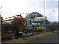
Vehicle depot
This is part of a large depot for Tayside Contracts gritting vehicles. The conical building in background holds a mountain of salt for spreading on the roads.
Image: © Rob Burke
Taken: 9 Feb 2008
0.08 miles
3
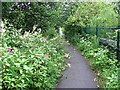
National Cycle Network - route 77
Path beside the River Almond used by the National Cycle Network. This area is completely dominated by Himalayan balsam in contrast to the wildflower meadows downstream.
Image: © Richard Webb
Taken: 18 Jul 2011
0.17 miles
4
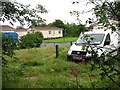
Static caravan park, Ruthvenfield Road
Image: © Richard Webb
Taken: 18 Jul 2011
0.18 miles
5
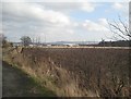
February fields
The distant buildings are the edge of the Inveralmond industrial estate.
Image: © Lis Burke
Taken: 9 Feb 2008
0.20 miles
6
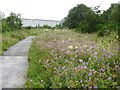
National Cycle Network - route 77
Another dull and rainy morning, but the flowers alongside the Almond still put on a big display. Hopefully they will continue to flourish here, but invasive aliens are in the area and the giant hogweed and Himalayan balsam could soon take over.
Image: © Richard Webb
Taken: 18 Jul 2011
0.21 miles
7
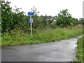
National Cycle Network - route 77
A path junction by Double Dykes. The main path continues to the right, on to Almondbank while a spur goes to Huntingtower.
Image: © Richard Webb
Taken: 18 Jul 2011
0.24 miles