
IMAGES TAKEN NEAR TO
Bamff Road, BLAIRGOWRIE, PH11 8DT
Introduction
This page details the photographs taken nearby to Bamff Road, PH11 8DT by members of the Geograph project.
The Geograph project started in 2005 with the aim of publishing, organising and preserving representative images for every square kilometre of Great Britain, Ireland and the Isle of Man.

There are currently over 7.5m images from over14,400 individuals and you can help contribute to the project by visiting https://www.geograph.org.uk
Image Map
Images are licensed for reuse under creativecommons.org/licenses/by-sa/2.0
Notes
- Clicking on the map will re-center to the selected point.
- The higher the marker number, the further away the image location is from the centre of the postcode.
Image Listing (105 Images Found)
Images are licensed for reuse under creativecommons.org/licenses/by-sa/2.0
Image
Details
Distance
1
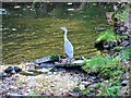
Heron beside the Alyth Burn
The grey heron stands beside the burn waiting to strike with its pick-axe of a bill at a fish, eel, mouse or a frog.
Image: © Maigheach-gheal
Taken: 3 Oct 2009
0.02 miles
2
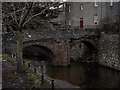
Alyth Footbridge
A footbridge over the burn in Alyth.
Image: © Colin Kinnear
Taken: 4 Jan 2009
0.03 miles
3
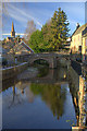
Bridge over Alyth Burn
Alyth parish church in background.
Image: © Dan
Taken: 3 Jan 2009
0.05 miles
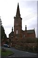
6
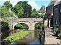
Old Pack Bridge, Alyth Burn, Alyth
The rubble pack bridge dates originally from c.1500 but was rebuilt in 1674. Some additions were made in the 19th century. It can only be used as a footbridge. The bridge is a Category B listed building. https://www.britishlistedbuildings.co.uk/200356263-old-packbridge-over-alyth-burn-strathmore-ward#.Wy5Z2jGWw5s
Image: © G Laird
Taken: 21 Jun 2018
0.06 miles
7
Alyth
Alyth (pronounced ay-lith, the 'ay' as in 'say') has a long history, having been founded in the 11th or 12th century. There are all sorts of traditions associated with it, for instance that Mordred imprisoned Queen Guinevere here. More certain is that Alyth grew in importance as a market town after the construction of the packhorse bridge, still open to pedestrians, was built over the Alyth Burn in the 16th century. Lots more information at http://www.geo.ed.ac.uk/scotgaz/towns/townhistory141.html.
Image: © Anne Burgess
Taken: Unknown
0.07 miles
9
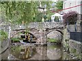
Alyth Burn
Repairs underway after severe flooding in July 2015.
Image: © Richard Webb
Taken: 16 Sep 2015
0.07 miles
10
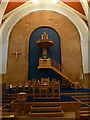
Alyth Parish Church, Pulpit
This pulpit was at the same height as the balcony which ran a long three sides of the church, so bringing the people who sat there into the service. The people who sat in the rest of the church must have the feeling of being watched, if not by God but by the minister himself.
Image: © Alexander P Kapp
Taken: 6 Sep 2012
0.07 miles