Old Pack Bridge, Alyth Burn, Alyth
Introduction
The photograph on this page of Old Pack Bridge, Alyth Burn, Alyth by G Laird as part of the Geograph project.
The Geograph project started in 2005 with the aim of publishing, organising and preserving representative images for every square kilometre of Great Britain, Ireland and the Isle of Man.

There are currently over 7.5m images from over 14,400 individuals and you can help contribute to the project by visiting https://www.geograph.org.uk
Old Pack Bridge, Alyth Burn, Alyth
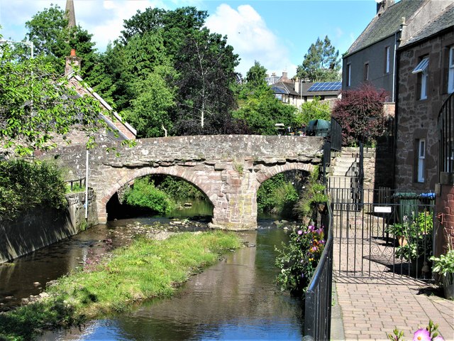
Image: © G Laird Taken: 21 Jun 2018
The rubble pack bridge dates originally from c.1500 but was rebuilt in 1674. Some additions were made in the 19th century. It can only be used as a footbridge. The bridge is a Category B listed building. https://www.britishlistedbuildings.co.uk/200356263-old-packbridge-over-alyth-burn-strathmore-ward#.Wy5Z2jGWw5s
Images are licensed for reuse under creativecommons.org/licenses/by-sa/2.0
Image Location
Latitude
56.624044
Longitude
-3.231908