IMAGES TAKEN NEAR TO
Dunkeld Place, Dunkeld Road, BLAIRGOWRIE, PH10 6RX

Introduction

This page details the photographs taken nearby to Dunkeld Place, Dunkeld Road, PH10 6RX by members of the Geograph project.

The Geograph project started in 2005 with the aim of publishing, organising and preserving representative images for every square kilometre of Great Britain, Ireland and the Isle of Man.

There are currently over 7.5m images from over14,400 individuals and you can help contribute to the project by visiting https://www.geograph.org.uk

Image Map


Images are licensed for reuse under creativecommons.org/licenses/by-sa/2.0
Notes
  • Clicking on the map will re-center to the selected point.
  • The higher the marker number, the further away the image location is from the centre of the postcode.

Image Listing (17 Images Found)

Images are licensed for reuse under creativecommons.org/licenses/by-sa/2.0
Image
Details
Distance
1
Dunkeld Road
On the outside of Blairgowrie, looking in.
Image: © Richard Webb Taken: 6 Sep 2013
0.01 miles
2
Barley stubble
Galabank off the Dunkeld Road on the edge of Blairgowrie.
Image: © Richard Webb Taken: 6 Sep 2013
0.05 miles
3
Ardblair trail footpath
Forming part of the circular walk known as the Ardblair Trail, this path is just north of the A923 Dunkeld Road.
Image: © James Allan Taken: 13 May 2013
0.13 miles
4
Tall and straight, Blairgowrie
Several varieties of poplar have been planted along this hedge line and the Galabank Path can just be seen where the trees have been felled.
Image: © Maigheach-gheal Taken: 16 Apr 2011
0.15 miles
5
Blairgowrie Community Hospital
Viewed from the junction of Perth Road and Ann Street. The premises opened as Blairgowrie and Rattray Districts Cottage Hospital on 30th May 1901.
Image: © Richard Dorrell Taken: 24 Feb 2013
0.17 miles
6
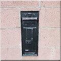
Black Victorian Wallbox
Black painted VR wallbox on the corner of the A93 Perth Road and A923 Dunkeld Road in Blairgowrie.
Image: © Scott Cormie Taken: 24 Dec 2021
0.18 miles
7
Fire station, Blairgowrie
Located in West George Street. The building was built in 1956 and officially opened on 2nd May 1958. The fire station has two front line appliances, a fully equipped rescue pump and a water tender ladder which are staffed by personnel employed on the retained duty system. The current establishment for the station is a Watch Manager, 3 x Crew Managers and 16 firefighters. Rear of building: Image
Image: © Richard Dorrell Taken: 24 Feb 2013
0.20 miles
8
Fire station, Blairgowrie
Viewed from Lochy Street, this is the rear of the fire station, which faces West George Street. The building dates from 1956. The tower structure on the left is used for training purposes. Front of building: Image
Image: © Richard Dorrell Taken: 24 Feb 2013
0.20 miles
9
Perth Road, Blairgowrie
The A93 heading northwards towards Blairgowrie town centre.
Image: © Scott Cormie Taken: 5 May 2019
0.20 miles
10
Wind break on Gallowhill
A row of young trees west of Blairgowrie.
Image: © James Allan Taken: 13 May 2013
0.21 miles