
IMAGES TAKEN NEAR TO
Eagle Way, PETERBOROUGH, PE7 8GR
Introduction
This page details the photographs taken nearby to Eagle Way, PE7 8GR by members of the Geograph project.
The Geograph project started in 2005 with the aim of publishing, organising and preserving representative images for every square kilometre of Great Britain, Ireland and the Isle of Man.

There are currently over 7.5m images from over14,400 individuals and you can help contribute to the project by visiting https://www.geograph.org.uk
Image Map
Images are licensed for reuse under creativecommons.org/licenses/by-sa/2.0
Notes
- Clicking on the map will re-center to the selected point.
- The higher the marker number, the further away the image location is from the centre of the postcode.
Image Listing (6 Images Found)
Images are licensed for reuse under creativecommons.org/licenses/by-sa/2.0
Image
Details
Distance
1
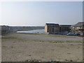
Wanted house builders
An area of land waiting for a development to take place in Hampton Hargate.
Image: © Michael Trolove
Taken: 21 Mar 2009
0.11 miles
2

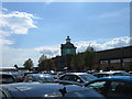
Serpentine Green shopping centre
Consisting of a large supermarket and ancillary shops, the shopping centre at Serpentine Green has been built on the former clay pits of the London Brick Company.
Image: © Michael Trolove
Taken: 21 Mar 2009
0.16 miles
3

Serpentine Green Shopping Centre
This retail complex is built on the unlikeliest brown field site. For decades the landscape around this area could have been described as lunar, it was the overburden and workings of the London Brick Company. The brick kilns of Fletton and Orton would have used the clay from these workings and it is a reasonable chance that your house may have bricks made of clay extracted from underneath this site.
Image: © Michael Trolove
Taken: 1 Nov 2008
0.22 miles
6

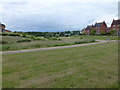
Houses by London Road, Hampton Vale
On the outskirts of Peterborough
Image: © David Howard
Taken: 6 Apr 2019
0.24 miles