
IMAGES TAKEN NEAR TO
Ruster Way, PETERBOROUGH, PE7 8FE
Introduction
This page details the photographs taken nearby to Ruster Way, PE7 8FE by members of the Geograph project.
The Geograph project started in 2005 with the aim of publishing, organising and preserving representative images for every square kilometre of Great Britain, Ireland and the Isle of Man.

There are currently over 7.5m images from over14,400 individuals and you can help contribute to the project by visiting https://www.geograph.org.uk
Image Map
Images are licensed for reuse under creativecommons.org/licenses/by-sa/2.0
Notes
- Clicking on the map will re-center to the selected point.
- The higher the marker number, the further away the image location is from the centre of the postcode.
Image Listing (11 Images Found)
Images are licensed for reuse under creativecommons.org/licenses/by-sa/2.0
Image
Details
Distance
1
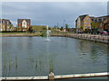
Lake and new houses, Hamptons, Peterborough
Image: © Richard Humphrey
Taken: 18 Jul 2011
0.11 miles
2
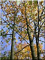
Autumn trees, Orton Pits
On the south side of the Orton Malborne/Goldhay junction roundabout.
Image: © Katie
Taken: 24 Oct 2004
0.11 miles
3
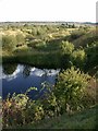
Orton Pits SSSI
Orton Pits is a Site of Special Scientific Interest, thanks to its unique landscape left over from clay extraction. It was once home to Europe's largest colony of Great Crested Newts...
Image: © Katie
Taken: 15 Sep 2004
0.16 miles
4
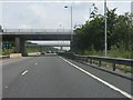
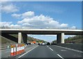
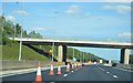
A1139 junction bridges, Orton Goldhay
A sign on the left indicates a lane gain between this junction and the next.
Image: © Peter Whatley
Taken: 27 Jul 2013
0.19 miles
5
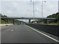
Between the roundabout bridges, A1139
Image: © Peter Whatley
Taken: 27 Jul 2013
0.19 miles
8
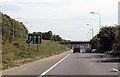
A1139 towards Peterborough
Passing through the Orton Goldhay region.
Image: © J.Hannan-Briggs
Taken: 21 Aug 2013
0.20 miles
10
Hampton Hargate: The Tump
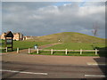
Tump is an alternative name for a circular bowl barrow burial mound, or a small hill in the middle of a village green. However this one, in the new township of Hampton Hargate on the southern outskirts of Peterborough, is a modern man-made mound. This is the view from Four Chimneys Crescent, the name reflecting the area's previous use as a brickworks.
Image: © Nigel Cox
Taken: 21 Jan 2012
0.21 miles