
IMAGES TAKEN NEAR TO
Commons Drive, PETERBOROUGH, PE7 8ES
Introduction
This page details the photographs taken nearby to Commons Drive, PE7 8ES by members of the Geograph project.
The Geograph project started in 2005 with the aim of publishing, organising and preserving representative images for every square kilometre of Great Britain, Ireland and the Isle of Man.

There are currently over 7.5m images from over14,400 individuals and you can help contribute to the project by visiting https://www.geograph.org.uk
Image Map
Images are licensed for reuse under creativecommons.org/licenses/by-sa/2.0
Notes
- Clicking on the map will re-center to the selected point.
- The higher the marker number, the further away the image location is from the centre of the postcode.
Image Listing (11 Images Found)
Images are licensed for reuse under creativecommons.org/licenses/by-sa/2.0
Image
Details
Distance
1
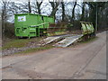
Wheel Washer Hampton Vale
To stop tipper lorries leaving a trail of mud on the main road a temporary wheel washing unit has been installed near to the A15 access point.
Image: © Michael Trolove
Taken: 27 Dec 2008
0.06 miles
2
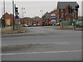
Road Junction To Hampton Vale
Built on the knot holes of the former clay pits this new community has been given the name of Hampton Vale.
Image: © Michael Trolove
Taken: 27 Dec 2008
0.06 miles
3
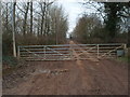
Access Road To The Former Orton Brick Yard
Soon to be reshaped into a further extension of the Hampton Vale township. Thousands of tons of earth have recently passed down this road in a major re shaping of the former clay pits.
Image: © Michael Trolove
Taken: 27 Dec 2008
0.07 miles
4

Heavy Plant Underpass Hampton Vale
With the ongoing earthworks all around this area, a crossing point was required to allow unhindered access to both side of the A15. Over a weekend the main road was closed and a cut and cover culvert was installed. Thousands of tons of soil, brick bats and other building materials have passed through this portal.
Image: © Michael Trolove
Taken: 27 Dec 2008
0.10 miles
5
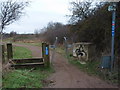
Control Gate for The Green Wheel Cycle Route Hampton
Part of the Green Wheel and the National Cycle Network routes 12 and 24 come together for 3 miles through a nature reserve and across farmland towards Haddon.
Image: © Michael Trolove
Taken: 27 Dec 2008
0.11 miles
6

Avery House on London Road, Hampton Vale
Image: © David Howard
Taken: 6 Apr 2019
0.11 miles
7

New Build Hampton Vale
A Sheltered Housing project being built by the entrance to Hampton Vale Peterborough
Image: © Michael Trolove
Taken: 27 Dec 2008
0.12 miles
8

Green Wheel Signage Hampton Vale
The Green Wheel is a cycling and walking route that encircles Peter borough. Designed for leisure and day to day cycling needs it has spokes that radiate from urban centres to allow access to most parts of the city. An all round trip is about 50 miles. At various points it links with the National Cycle network.
Image: © Michael Trolove
Taken: 27 Dec 2008
0.14 miles

10
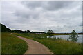
Path by Beeby's West Lake, Hampton, Peterborough
A former brick clay pit, with the new housing development of Hampton Water in the distance.
Image: © Tim Heaton
Taken: 15 Jul 2021
0.20 miles