
IMAGES TAKEN NEAR TO
Bedstone Way, PETERBOROUGH, PE7 3DW
Introduction
This page details the photographs taken nearby to Bedstone Way, PE7 3DW by members of the Geograph project.
The Geograph project started in 2005 with the aim of publishing, organising and preserving representative images for every square kilometre of Great Britain, Ireland and the Isle of Man.

There are currently over 7.5m images from over14,400 individuals and you can help contribute to the project by visiting https://www.geograph.org.uk
Image Map
Images are licensed for reuse under creativecommons.org/licenses/by-sa/2.0
Notes
- Clicking on the map will re-center to the selected point.
- The higher the marker number, the further away the image location is from the centre of the postcode.
Image Listing (17 Images Found)
Images are licensed for reuse under creativecommons.org/licenses/by-sa/2.0
Image
Details
Distance
1

Crawler crane operating near Stanground
A crawler crane from the Weldex fleet http://www.weldex.co.uk/main.html operating on a major infrastructure project between Farcet and Stanground.
Image: © Michael Trolove
Taken: 26 Apr 2009
0.03 miles
2

Drilling rig on roadworks near Stanground
A Bauer MBG 24 set up for drilling foundation piles.
Image: © Michael Trolove
Taken: 26 Apr 2009
0.06 miles
3
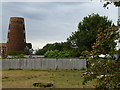
Mill tower between Stanground and Farcet
This old windmill near Peterborough is now a domestic dwelling
Image: © Richard Humphrey
Taken: 13 Jul 2011
0.07 miles
4

A short dual carriageway
Probably Britain's shortest dual carriageway at this moment. Part of the Stanground relief road being built between Horsey Toll and Farcet.
Image: © Michael Trolove
Taken: 18 Oct 2009
0.07 miles
5
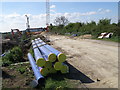
Roadworks, Stanground
Water pipe store area on the major development site near Stanground.
Image: © Michael Trolove
Taken: 26 Apr 2009
0.08 miles
6

Heavy plant on site near Stanground
A Bauer drilling rig, a Komatsu excavator and a crawler crane make unknown Image(for anyone who can identify it) near the roadside at Stanground.
Image: © Michael Trolove
Taken: 26 Apr 2009
0.08 miles
7

Road construction near Farcet
A new access road being constructed for the large warehousing development between Old Fletton and Farcet.
Image: © Michael Trolove
Taken: 26 Apr 2009
0.08 miles
8
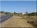
Infrastructure developments on the Stanground Farcet road
Development plans for an area of land between Farcet and Stanground are finally being put into place. Housing, access roads and warehousing will be built to further enlarge the Greater Peterborough footprint.
Image: © Michael Trolove
Taken: 26 Apr 2009
0.08 miles
9
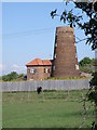
Windmill tower near Stanground
Windmill tower with a house crafted onto the back.
Image: © Michael Trolove
Taken: 26 Apr 2009
0.08 miles
10
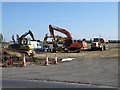
Plant parking, Stanground
Heavy plant on a Sunday break. The site is destined for major warehouse, housing and by pass development. The project appears to be at the breaking ground stage, road access and services going in.
Image: © Michael Trolove
Taken: 26 Apr 2009
0.09 miles