
IMAGES TAKEN NEAR TO
Bretton Gate, PETERBOROUGH, PE3 9UZ
Introduction
This page details the photographs taken nearby to Bretton Gate, PE3 9UZ by members of the Geograph project.
The Geograph project started in 2005 with the aim of publishing, organising and preserving representative images for every square kilometre of Great Britain, Ireland and the Isle of Man.

There are currently over 7.5m images from over14,400 individuals and you can help contribute to the project by visiting https://www.geograph.org.uk
Image Map
Images are licensed for reuse under creativecommons.org/licenses/by-sa/2.0
Notes
- Clicking on the map will re-center to the selected point.
- The higher the marker number, the further away the image location is from the centre of the postcode.
Image Listing (23 Images Found)
Images are licensed for reuse under creativecommons.org/licenses/by-sa/2.0
Image
Details
Distance
1
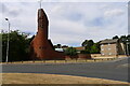
Church of St Jude, Westwood, Peterborough
Building started in 1968 on land donated by the Fitzwilliam Trust (Cf. Fitzwilliam family of Bretton Park), to serve the new housing estates being developed on the west side of Peterborough http://www.stjudepeterborough.org.uk/about-us/our-history/
Image: © Tim Heaton
Taken: 9 Aug 2022
0.11 miles
2
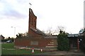
St Judes C of E church Westwood
Modern Church with striking tower design
Image: © Chris Stafford
Taken: 18 Jan 2007
0.12 miles
3
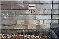
Benchmark on electricity substation wall, Atherstone Avenue
Ordnance Survey cut mark benchmark described on the Bench Mark Database at www.bench-marks.org/bm88353
Image: © phil Richards
Taken: 22 Oct 2017
0.12 miles
4
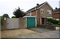
Electricity substation and No. 62 Atherstone Avenue
There is an Ordnance Survey benchmark Image on the wall of the substation enclosure left of the garage door
Image: © phil Richards
Taken: 22 Oct 2017
0.13 miles
5
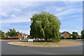
Roundabout 47, available for sponsorship
Poor, unloved thing. Nice tree though.
Image: © Tim Heaton
Taken: 9 Aug 2022
0.14 miles
6
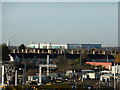
Peterborough City Hospital
The replacement for the old District Hospital, and a massive PFI millstone around the neck of the local trust.
Seen here across the intervening rooftops of Westwood, from the roof of the Queensgate car park.
Image: © Bob Harvey
Taken: 17 Dec 2013
0.15 miles
7
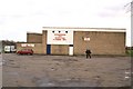
The Hockey Club HQ and climbing wall
Near to the Edith Cavell NHS hospital, a popular site on Sunday mornings
Image: © Chris Stafford
Taken: 18 Jan 2007
0.15 miles
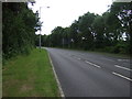
9
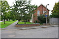
No. 19 Ledbury Road
Ordnance Survey documents indicate that in 1965 a benchmark was levelled at 17.523m above Newlyn Datum on the right hand side of the gap in the roadside wall through which access to the house was provided.
Image: © phil Richards
Taken: 22 Oct 2017
0.22 miles
10
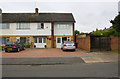
Houses on west side of Wilton Drive
Ordnance Survey documents indicate that a benchmark levelled at 17.852m above Newlyn Datum was cut on the garage behind #2 Wilton Drive in 1965. However, it appears the garage has been demolished and the houses rebuilt. See www.bench-marks.org.uk/bm88358
Image: © phil Richards
Taken: 22 Oct 2017
0.22 miles