
IMAGES TAKEN NEAR TO
Saffron Close, DOWNHAM MARKET, PE38 9UP
Introduction
This page details the photographs taken nearby to Saffron Close, PE38 9UP by members of the Geograph project.
The Geograph project started in 2005 with the aim of publishing, organising and preserving representative images for every square kilometre of Great Britain, Ireland and the Isle of Man.

There are currently over 7.5m images from over14,400 individuals and you can help contribute to the project by visiting https://www.geograph.org.uk
Image Map
Images are licensed for reuse under creativecommons.org/licenses/by-sa/2.0
Notes
- Clicking on the map will re-center to the selected point.
- The higher the marker number, the further away the image location is from the centre of the postcode.
Image Listing (12 Images Found)
Images are licensed for reuse under creativecommons.org/licenses/by-sa/2.0
Image
Details
Distance


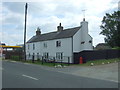
5

Housing on the eastern edge of Downham Market
Image: © Richard Humphrey
Taken: 8 Sep 2016
0.21 miles
7

New housing estate in Downham Market
A lot of building is currently taking place in Downham Market, presumably to keep up with the ever-widening radius of London commuting. Only 30 minutes by train into Cambridge, and under an hour an half into London Kings Cross.
Image: © Fractal Angel
Taken: 10 Aug 2007
0.22 miles
8

Old Milestone by the B1507, Lynn Road, Wimbotsham
Metal plate attached to stone post by the B1507, in parish of DOWNHAM MARKET (KINGS LYNN AND WEST NORFOLK District), Lynn Road, Wimbotsham, by No.149, South of junction with Low Road, on the verge, on West side of road. Erected by the Lynn - South Gate turnpike trust in the 19th century.
Inscription reads:- : Wimbotsham / 6F. to the / Checker / in Downham :
Milestone Society National ID: NO_KLDM10.
Image: © MW Hallett
Taken: 28 Dec 2003
0.23 miles
9

Old Milestone
Old milestone on what was the A.10 near to Wimbotsham, Norfolk. For overall view see http://www.geograph.org.uk/photo/1714826 I would think that the F stands for furlongs ands translates to 3/4 of a mile.
Image: © Keith Evans
Taken: 17 Feb 2010
0.23 miles
