
IMAGES TAKEN NEAR TO
Red Hart Close, DOWNHAM MARKET, PE38 0BF
Introduction
This page details the photographs taken nearby to Red Hart Close, PE38 0BF by members of the Geograph project.
The Geograph project started in 2005 with the aim of publishing, organising and preserving representative images for every square kilometre of Great Britain, Ireland and the Isle of Man.

There are currently over 7.5m images from over14,400 individuals and you can help contribute to the project by visiting https://www.geograph.org.uk
Image Map
Images are licensed for reuse under creativecommons.org/licenses/by-sa/2.0
Notes
- Clicking on the map will re-center to the selected point.
- The higher the marker number, the further away the image location is from the centre of the postcode.
Image Listing (17 Images Found)
Images are licensed for reuse under creativecommons.org/licenses/by-sa/2.0
Image
Details
Distance
1

A1122 approaching Nordelph
View across the A1122 from the dike which runs parallel with Well Creek. The property seen in the background is Eastview.
Image: © Evelyn Simak
Taken: 19 Apr 2009
0.04 miles
2

Outwell Drove at the junction of Barroway Drove Road
Image: © David Howard
Taken: 27 Feb 2022
0.04 miles
3

View along Well Creek
The road seen at left is the A1122, approaching the village of Nordelph.
Image: © Evelyn Simak
Taken: 19 Apr 2009
0.08 miles

5

Crop field towards East Farm
Off Barroway Drove.
Image: © JThomas
Taken: 5 Oct 2020
0.11 miles
6
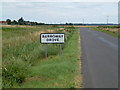
Barroway Drove
A linear village settlement along an ancient drove
Image: © Richard Humphrey
Taken: 23 Aug 2012
0.15 miles
7

Trig pillar on banks of Well Creek, west of Nordelph.
The pillar is just east of the grid line; looking northwest into TF5401.
Image: © Dr Charles Nelson
Taken: 26 Oct 2005
0.15 miles
8

Garden shed, Nordelph.
Everything is clipped!
Image: © Dr Charles Nelson
Taken: 30 Oct 2005
0.17 miles

10

Farm bridge over the Well Creek
Gives access to White House Farm.
Image: © Rose and Trev Clough
Taken: 4 Jun 2006
0.21 miles