
IMAGES TAKEN NEAR TO
Downham Road, DOWNHAM MARKET, PE38 0AY
Introduction
This page details the photographs taken nearby to Downham Road, PE38 0AY by members of the Geograph project.
The Geograph project started in 2005 with the aim of publishing, organising and preserving representative images for every square kilometre of Great Britain, Ireland and the Isle of Man.

There are currently over 7.5m images from over14,400 individuals and you can help contribute to the project by visiting https://www.geograph.org.uk
Image Map
Images are licensed for reuse under creativecommons.org/licenses/by-sa/2.0
Notes
- Clicking on the map will re-center to the selected point.
- The higher the marker number, the further away the image location is from the centre of the postcode.
Image Listing (27 Images Found)
Images are licensed for reuse under creativecommons.org/licenses/by-sa/2.0
Image
Details
Distance
1

River Great Ouse
The section north of Denver Sluice is tidal.
Image: © Hugh Venables
Taken: 3 Dec 2011
0.05 miles

3

Bridleway by River Great Ouse
Along the raised bank, looking down to the farmland.
Image: © Hugh Venables
Taken: 6 Dec 2015
0.09 miles
5

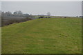
Bank of the Great Ouse
See Image for a view before the arable fields were converted to wetland.
Image: © Hugh Venables
Taken: 26 Jun 2022
0.10 miles
6

Feeder by River Great Ouse
The river banks are grazed, unlike the largely arable farmland beyond.
Image: © Hugh Venables
Taken: 3 Dec 2011
0.10 miles


9

The Great Ouse between Downham Market and Salter's Lode
Image: © Richard Humphrey
Taken: 26 Aug 2016
0.11 miles
10

Former arable land near Denver Sluice
The area is relatively small and bounded by The Great Ouse and the Relief Channel, which makes it a good area to change water levels without affecting any neighbouring fields.
Image: © Hugh Venables
Taken: 26 Jun 2022
0.14 miles