
IMAGES TAKEN NEAR TO
Castle Road, KING'S LYNN, PE33 0SG
Introduction
This page details the photographs taken nearby to Castle Road, PE33 0SG by members of the Geograph project.
The Geograph project started in 2005 with the aim of publishing, organising and preserving representative images for every square kilometre of Great Britain, Ireland and the Isle of Man.

There are currently over 7.5m images from over14,400 individuals and you can help contribute to the project by visiting https://www.geograph.org.uk
Image Map
Images are licensed for reuse under creativecommons.org/licenses/by-sa/2.0
Notes
- Clicking on the map will re-center to the selected point.
- The higher the marker number, the further away the image location is from the centre of the postcode.
Image Listing (25 Images Found)
Images are licensed for reuse under creativecommons.org/licenses/by-sa/2.0
Image
Details
Distance
1
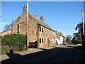
Cottages in Wormegay
Wormegay village is situated about 9 kilometres south of King's Lynn (King's Lynn and West Norfolk district) and covers an area of approximately 12 square kilometres. The remains of a medieval cross can be seen on the green by the junction of Castle Road and Saxon Way. Wormegay Castle, a motte and bailey earthwork, lies immediately to the west of the village centre. Wormegay once used to be grouped around its church > http://www.geograph.org.uk/photo/1742397 - it is dedicated to St Michael and All Angels and Holy Cross - until the mid-14th century, when the location was abandoned either because of the Black Death (the plague) which was brought to England by troops returning from the crusades to the second most important port in the country, King's Lynn, or because the land had become infertile due to over-farming.
Image: © Evelyn Simak
Taken: 4 Mar 2010
0.02 miles
2
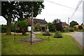
Village green in Wormegay
This impressively-equipped small green has a sign, a war memorial, an ancient cross, a bench, a litter bin, a tree, a notice board, and a post box.
Image: © Ben Harris
Taken: 18 Aug 2007
0.07 miles
3

Cottages in Wormegay
Wormegay village is situated about 9 kilometres south of King's Lynn (King's Lynn and West Norfolk district) and covers an area of approximately 12 square kilometres. The remains of a medieval cross can be seen on the green by the junction of Castle Road and Saxon Way. Wormegay Castle, a motte and bailey earthwork, lies immediately to the west of the village centre. Wormegay once used to be grouped around its church > http://www.geograph.org.uk/photo/1742397 - it is dedicated to St Michael and All Angels and Holy Cross - until the mid-14th century, when the location was abandoned either because of the Black Death (the plague) which was brought to England by troops returning from the crusades to the second most important port in the country, King's Lynn, or because the land had become infertile due to over-farming.
Image: © Evelyn Simak
Taken: 4 Mar 2010
0.07 miles
4

Cottages by the village green in Wormegay
The remains of a medieval stone cross can be seen at right, on the village green.
Wormegay village is situated about 9 kilometres south of King's Lynn (King's Lynn and West Norfolk district) and covers an area of approximately 12 square kilometres. The remains of a medieval cross can be seen on the green by the junction of Castle Road and Saxon Way. Wormegay Castle, a motte and bailey earthwork, lies immediately to the west of the village centre. Wormegay once used to be grouped around its church > http://www.geograph.org.uk/photo/1742397 - it is dedicated to St Michael and All Angels and Holy Cross - until the mid-14th century, when the location was abandoned either because of the Black Death (the plague) which was brought to England by troops returning from the crusades to the second most important port in the country, King's Lynn, or because the land had become infertile due to over-farming.
Image: © Evelyn Simak
Taken: 4 Mar 2010
0.08 miles

6
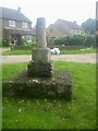
Old Wayside Cross
Wormegay Cross, a central cross with an old shaft, base & steps. Set on the east side of The Green, at the junction of Castle Road and Saxon Way in Wormegay parish. Grade II Listed https://historicengland.org.uk/listing/the-list/list-entry/1152337. See also http://www.geograph.org.uk/photo/1742331.
Milestone Society National ID: NOKL_WOR
Image: © R Hetherington
Taken: 24 Jun 2019
0.10 miles
7

Cottages in Wormegay
Wormegay village is situated about 9 kilometres south of King's Lynn (King's Lynn and West Norfolk district) and covers an area of approximately 12 square kilometres. The remains of a medieval cross can be seen on the green by the junction of Castle Road and Saxon Way. Wormegay Castle, a motte and bailey earthwork, lies immediately to the west of the village centre. Wormegay once used to be grouped around its church > http://www.geograph.org.uk/photo/1742397 - it is dedicated to St Michael and All Angels and Holy Cross - until the mid-14th century, when the location was abandoned either because of the Black Death (the plague) which was brought to England by troops returning from the crusades to the second most important port in the country, King's Lynn, or because the land had become infertile due to over-farming.
Image: © Evelyn Simak
Taken: 4 Mar 2010
0.10 miles
8
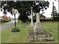
Old broken preaching cross and Wormegay War Memorial
The village sign https://www.geograph.org.uk/photo/4589197 is also in the picture.
The War Memorial has eight names of men who were lost in WW1 and of one who was lost in WW2.
Image: © Adrian S Pye
Taken: 27 Jul 2015
0.10 miles
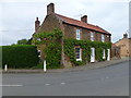
10
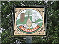
Wormegay village sign
A representation of how Wormegay castle would have appeared when it controlled the causeway across The Fens, the church of St Michael and All Angels is well to the east of the present village which settled round the castle. The river is actually the Polver Drain which feeds into the relief channel of the Great Ouse at Wiggenhall. The bridge is at the eastern end of Castle Road floodplain and causeway. The village has a strong agricultural heritage, hence the pig, horse, wheatsheaf and sheep.
Image: © Adrian S Pye
Taken: 27 Jul 2015
0.11 miles