
IMAGES TAKEN NEAR TO
Cubitt Way, PETERBOROUGH, PE2 9NG
Introduction
This page details the photographs taken nearby to Cubitt Way, PE2 9NG by members of the Geograph project.
The Geograph project started in 2005 with the aim of publishing, organising and preserving representative images for every square kilometre of Great Britain, Ireland and the Isle of Man.

There are currently over 7.5m images from over14,400 individuals and you can help contribute to the project by visiting https://www.geograph.org.uk
Image Map
Images are licensed for reuse under creativecommons.org/licenses/by-sa/2.0
Notes
- Clicking on the map will re-center to the selected point.
- The higher the marker number, the further away the image location is from the centre of the postcode.
Image Listing (464 Images Found)
Images are licensed for reuse under creativecommons.org/licenses/by-sa/2.0
Image
Details
Distance

2

Low Rise Apartments
These new housing units have been built on the site of the former Marshalls car retail site which over the years traded in British Leyland, Isuzu and Jeep and probably many other marques before that.
Image: © Michael Trolove
Taken: 21 Sep 2008
0.02 miles
3

Cubitt Way
Colourful blocks of flats off the A605.
Image: © Bill Boaden
Taken: 14 May 2021
0.02 miles
4

Apartment blocks on the A605 in Peterborough
Image: © Mat Fascione
Taken: 3 Apr 2016
0.03 miles
5

Railway Bridge
The bridge carries the east coast main line across low ground near the river Nene.
Image: © Michael Trolove
Taken: 21 Sep 2008
0.05 miles
6

East Coast HST crosses viaduct across the River Nene
An East Coast HST heads south with Class 43 power car number 43318 leading (43311 at rear). Peterborough Cathedral can be seen in the background immediately to the right of the HST.
Image: © Roger Templeman
Taken: 16 Apr 2011
0.05 miles
7

New Low Rise Apartments
Formerly Marshalls garage on Oundle road, these bright coloured low rise apartments shine on a sunny day.
Image: © Michael Trolove
Taken: 21 Sep 2008
0.06 miles
8

The Green Backyard, Fletton, Peterborough, Cambs.
The Green Backyard is a community garden project accessed from the A605 (a.k.a. Oundle Road) near its junction with the A15 (a.k.a. London Road). The site is an elongated plot of land running parallel with London Road, i.e. Peterborough Football Club’s stadium can be seen from the eastern boundary of the Green Backyard site. This ‘green’ project was established in 2009 from a derelict former allotment site. It became a registered charity in January 2014. https://www.thegreenbackyard.com/
Image: © David Hallam-Jones
Taken: 19 Aug 2019
0.06 miles
9

Towards The Cherry Tree Pub Oundle Road
Image: © Michael Trolove
Taken: 21 Sep 2008
0.06 miles
10
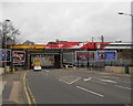
Virgin train crosses the railway bridge on Oundle Road, Peterborough
Image: © Paul Bryan
Taken: 26 Mar 2016
0.06 miles