
IMAGES TAKEN NEAR TO
Celta Road, PETERBOROUGH, PE2 9JD
Introduction
This page details the photographs taken nearby to Celta Road, PE2 9JD by members of the Geograph project.
The Geograph project started in 2005 with the aim of publishing, organising and preserving representative images for every square kilometre of Great Britain, Ireland and the Isle of Man.

There are currently over 7.5m images from over14,400 individuals and you can help contribute to the project by visiting https://www.geograph.org.uk
Image Map
Images are licensed for reuse under creativecommons.org/licenses/by-sa/2.0
Notes
- Clicking on the map will re-center to the selected point.
- The higher the marker number, the further away the image location is from the centre of the postcode.
Image Listing (49 Images Found)
Images are licensed for reuse under creativecommons.org/licenses/by-sa/2.0
Image
Details
Distance
1

Railway bridge, Celta road
The bridge carries a railway track from the East Coast main line to the Nene Valley Railway. The line appears to be intact but I am not sure if it is still used for visiting rolling stock to the NVR
As for the Hotpoint banner the end of an era as manufacturing of white goods has ceased at the Morley Way factory just beyond the bridge.
Image: © Michael Trolove
Taken: 13 Sep 2009
0.06 miles
2

Benchmark on #46 Belsize Avenue
Ordnance Survey cut mark benchmark described on the Bench Mark Database at https://www.bench-marks.org.uk/bm99551
Image: © Roger Templeman
Taken: 12 Sep 2018
0.07 miles
3

Playground off Celta Road, Woodston
Woodston Primary School behind.
Image: © Tim Heaton
Taken: 8 Mar 2025
0.08 miles
4

Railway bridge, Celta Road, Peterborough
Image: © Richard Humphrey
Taken: 9 May 2011
0.08 miles
5

Railway bridge over Celta Road in Peterborough
The Hotpoint factory can be seen in the distance
Image: © Richard Humphrey
Taken: 9 May 2011
0.08 miles
6

Benchmark on Celta Road railway bridge wall
Ordnance Survey cut mark benchmark described on the Bench Mark Database at https://www.bench-marks.org.uk/bm99550
Image: © Roger Templeman
Taken: 12 Sep 2018
0.09 miles
7

Celta Road wall NW of railway overbridge
There is an OS benchmark Image on the wall near its left hand end
Image: © Roger Templeman
Taken: 12 Sep 2018
0.09 miles

9
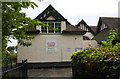
Approach to Old Fletton Primary School from London Road
Image: © Roger Templeman
Taken: 12 Sep 2018
0.11 miles
10

Fletton Branch Railway Bridge
This bridge to the south of Peterborough carries the Fletton loop link track from the preserved Nene Valley Railway to the east coast main line. This part of the line is not used for regular passenger trains on the preserved railway but it does provide a useful link for moving locomotives and railtour specials to and from the main line.
Image: © Mike Bardill
Taken: 30 Apr 2006
0.11 miles