
IMAGES TAKEN NEAR TO
Wootton Avenue, PETERBOROUGH, PE2 9EG
Introduction
This page details the photographs taken nearby to Wootton Avenue, PE2 9EG by members of the Geograph project.
The Geograph project started in 2005 with the aim of publishing, organising and preserving representative images for every square kilometre of Great Britain, Ireland and the Isle of Man.

There are currently over 7.5m images from over14,400 individuals and you can help contribute to the project by visiting https://www.geograph.org.uk
Image Map
Images are licensed for reuse under creativecommons.org/licenses/by-sa/2.0
Notes
- Clicking on the map will re-center to the selected point.
- The higher the marker number, the further away the image location is from the centre of the postcode.
Image Listing (46 Images Found)
Images are licensed for reuse under creativecommons.org/licenses/by-sa/2.0
Image
Details
Distance
1

Woodston Branch Line
Viewed from London Road looking east. This line would have served the brick yards and the sugar beet factory. Both long gone.
Image: © Michael Trolove
Taken: 21 Sep 2008
0.04 miles
2
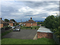
Houses and garages, Wootton Avenue, Old Fletton, Peterborough
The blue building in the background is the colossal (460x190m) IKEA distribution centre in Image and seen on the right in Image
Image: © Robin Stott
Taken: 25 Jun 2016
0.04 miles
3

St Margarets Road, Old Fletton, Peterborough
Image: © Robin Stott
Taken: 25 Jun 2016
0.07 miles
5
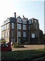
Phorpres House
This elegant grand house with imposing steps to the front door no doubt showed London Brick companies bricks to good effect. Now converted to flats.
Image: © Michael Trolove
Taken: 21 Sep 2008
0.10 miles

8

Fletton Branch Railway (1)
The Great Northern Railway built this branch line from Fletton Junction to Longueville Junction on the London & North Western Railway's line from Northampton to Peterborough, a distance, in railway terms, of 1 mile and 50 chains. Today the branch line enables a connection to be made between Network Rail tracks and the Nene Valley Railway.
When it was built the railway ran through an agricultural landscape, but as Peterborough grew the line formed the southern boundary of the residential expansion with the brick works beyond. Today, with the brick works gone, that residential zone has now begun to expand beyond the railway.
This is the view looking towards Fletton Junction from the London Road bridge.
Image: © Nigel Cox
Taken: 21 Jan 2012
0.11 miles
9
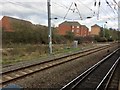
View from a Peterborough-London train - Junction with Nene Valley Railway
Although not used by passenger trains, this junction does give a connection for rolling stock moves around the rail network.
Image: © Nigel Thompson
Taken: 18 Mar 2017
0.11 miles
10

London Road railway bridge
There is an OS benchmark Image near the far end of the right hand parapet
Image: © Roger Templeman
Taken: 12 Sep 2018
0.12 miles