
IMAGES TAKEN NEAR TO
Theodore Close, PETERBOROUGH, PE2 8WW
Introduction
This page details the photographs taken nearby to Theodore Close, PE2 8WW by members of the Geograph project.
The Geograph project started in 2005 with the aim of publishing, organising and preserving representative images for every square kilometre of Great Britain, Ireland and the Isle of Man.

There are currently over 7.5m images from over14,400 individuals and you can help contribute to the project by visiting https://www.geograph.org.uk
Image Map
Images are licensed for reuse under creativecommons.org/licenses/by-sa/2.0
Notes
- Clicking on the map will re-center to the selected point.
- The higher the marker number, the further away the image location is from the centre of the postcode.
Image Listing (17 Images Found)
Images are licensed for reuse under creativecommons.org/licenses/by-sa/2.0
Image
Details
Distance


3

Houses under construction, Stanground South
Image: © Hugh Venables
Taken: 5 May 2019
0.13 miles
4

The Fenman, Stanground
Pub on the outskirts of Peterborough
(Demolished in 2021)
Image: © Richard Humphrey
Taken: 14 Apr 2011
0.16 miles

6

Persimmon show home, Stanground South
Part of a large expansion of Peterborough.
Image: © Hugh Venables
Taken: 5 May 2019
0.17 miles
7
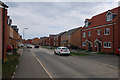
Stanground South, Peterborough
Recently built and with more houses under construction.
Image: © Hugh Venables
Taken: 5 May 2019
0.17 miles
8

Peterborough soon to get a new Morrisons
A new housing development also sees a brand new Supermarket under the Morrisons Banner. The development south of Stanground is to be known as Cardea. See Image Scheduled opening is Autumn 2011 but for now it's a building site hidden behind a continuous screen.
Image: © Michael Trolove
Taken: 30 Jun 2011
0.18 miles
9
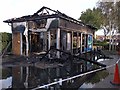
Fire in car wash, Stanground, Peterborough
This car wash caught fire in the early hours of Sunday 13th October 2013. It is right next to the fuel delivery points for a large filling station on Whittlesey Road in a built up area. Fortunately the fuel station is open round the clock so the alarm was raised immediately and the fire station, see http://www.geograph.org.uk/photo/629863, is only a mile away so a major disaster was prevented
Image: © Sandra Humphrey
Taken: 13 Oct 2013
0.18 miles
10

Bellona Drive, Stanground South
With building ongoing.
Image: © Hugh Venables
Taken: 5 May 2019
0.18 miles