
IMAGES TAKEN NEAR TO
Bellona Drive, PETERBOROUGH, PE2 8WH
Introduction
This page details the photographs taken nearby to Bellona Drive, PE2 8WH by members of the Geograph project.
The Geograph project started in 2005 with the aim of publishing, organising and preserving representative images for every square kilometre of Great Britain, Ireland and the Isle of Man.

There are currently over 7.5m images from over14,400 individuals and you can help contribute to the project by visiting https://www.geograph.org.uk
Image Map
Images are licensed for reuse under creativecommons.org/licenses/by-sa/2.0
Notes
- Clicking on the map will re-center to the selected point.
- The higher the marker number, the further away the image location is from the centre of the postcode.
Image Listing (13 Images Found)
Images are licensed for reuse under creativecommons.org/licenses/by-sa/2.0
Image
Details
Distance


3

Big pipes near Stanground
Some major changes to the landscape are planned with warehousing roads and houses on arable land between Farcet and Stanground. Some basis infrastructure has already gone in but the economic slowdown may impact the speed of work on this development.
Image: © Michael Trolove
Taken: 24 May 2009
0.11 miles

5
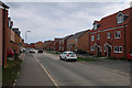
Stanground South, Peterborough
Recently built and with more houses under construction.
Image: © Hugh Venables
Taken: 5 May 2019
0.17 miles
6

Houses under construction, Stanground South
Image: © Hugh Venables
Taken: 5 May 2019
0.18 miles
7

River Nene (old course) near Stanground, Peterborough
...
Image: © Richard Humphrey
Taken: 14 Apr 2011
0.20 miles
8

Cycle Route 12 bridge over the River Nene (old course)
In the distance; new homes of the Cardea development site, Stanground
Image: © Tim Heaton
Taken: 15 Jul 2021
0.20 miles
9

Persimmon show home, Stanground South
Part of a large expansion of Peterborough.
Image: © Hugh Venables
Taken: 5 May 2019
0.22 miles
10

Pond on the edge of Stanground by-pass
This recently opened section of the A605 gave Stanground, Peterborough a long awaited by-pass and also opened up a few hundred acres of land for housing development.
Image: © Richard Humphrey
Taken: 13 Jul 2011
0.22 miles