
IMAGES TAKEN NEAR TO
Beeston Drive, PETERBOROUGH, PE2 8UH
Introduction
This page details the photographs taken nearby to Beeston Drive, PE2 8UH by members of the Geograph project.
The Geograph project started in 2005 with the aim of publishing, organising and preserving representative images for every square kilometre of Great Britain, Ireland and the Isle of Man.

There are currently over 7.5m images from over14,400 individuals and you can help contribute to the project by visiting https://www.geograph.org.uk
Image Map
Images are licensed for reuse under creativecommons.org/licenses/by-sa/2.0
Notes
- Clicking on the map will re-center to the selected point.
- The higher the marker number, the further away the image location is from the centre of the postcode.
Image Listing (14 Images Found)
Images are licensed for reuse under creativecommons.org/licenses/by-sa/2.0
Image
Details
Distance
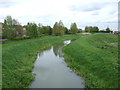
2
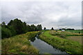
The old course of the River Nene from Horsey Bridge
Forming the south-east boundary of Peterborough.
Image: © Tim Heaton
Taken: 15 Jul 2021
0.06 miles
3
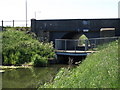
Three level bridge near Horsey Toll
The A605 Stanground to Whittlesey road over the top, cycling and pedestrians through the middle and the Old Nene at the lower level.
Image: © Michael Trolove
Taken: 24 May 2009
0.07 miles
4

OSBM Flush Bracket G659 - Stanground, Horsey Bridge
Ordnance Survey Benchmark (OSBM) used for levelling height above Ordnance Datum (OD).
Height (1955): 4.3321m OD (Newlyn). Mark verified by the Ordnance Survey in 1969. Description: FL BR G659 HORSEY BR N PARA E END N FACE. 1.1m above ground. 1st Order BM. TL 2203 9605
The bracket was used on the Wicken to Castor line (G104) of the Third Geodetic Levelling of England & Wales in 1955. Abstract G 72: https://discovery.nationalarchives.gov.uk/details/r/C11264480 [OS 54/761]
Context: Image
Image: © N Scott
Taken: 2 Aug 2025
0.08 miles
5

OSBM Flush Bracket G659 - Stanground, Horsey Bridge
Ordnance Survey Benchmark (OSBM) used for levelling height above Ordnance Datum (OD).
Height (1955): 4.3321m OD (Newlyn). Mark verified by the Ordnance Survey in 1969. Description: FL BR G659 HORSEY BR N PARA E END N FACE. 1.1m above ground. 1st Order BM. TL 2203 9605
The bracket was used on the Wicken to Castor line (G104) of the Third Geodetic Levelling of England & Wales in 1955. Abstract G 72: https://discovery.nationalarchives.gov.uk/details/r/C11264480 [OS 54/761]
Close-up: Image
Image: © N Scott
Taken: 2 Aug 2025
0.08 miles
7
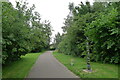
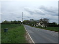
National Cycle Route 12 on the perimeter of Stanground, Peterborough
Part of the city's extensive cycle path network.
Image: © Tim Heaton
Taken: 15 Jul 2021
0.13 miles
8

Landscape around Horsey Toll
Wind turbines, tower cranes, arable crops and hidden from view clay pits for the nearby brick making industry all part of the landscape east of Peterborough.
Image: © Michael Trolove
Taken: 24 May 2009
0.18 miles
9
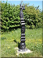
National Cycle Network mile post
12 miles to Huntingdon from this point on the edge of Stanground.
Image: © Michael Trolove
Taken: 24 May 2009
0.20 miles
10
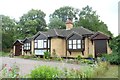
Tollhouse by the A605, Horsey Hill, Peterborough
Tollhouse by the A605, in the parish of Peterborough (Peterborough District), Horsey Hill Tollhouse, Toll Road, Old Fletton, PE7 2PP.
The Tollhouse stands within the area of the Horsey Hill Civil War Fort which is a
Scheduled Monument.
List Entry Number: 1015201 https://historicengland.org.uk/listing/the-list/list-entry/1015201
To be surveyed
Milestone Society National ID: CA.PET
Image: © Milestone Society
Taken: Unknown
0.20 miles