
IMAGES TAKEN NEAR TO
Turnstone Way, PETERBOROUGH, PE2 8SW
Introduction
This page details the photographs taken nearby to Turnstone Way, PE2 8SW by members of the Geograph project.
The Geograph project started in 2005 with the aim of publishing, organising and preserving representative images for every square kilometre of Great Britain, Ireland and the Isle of Man.

There are currently over 7.5m images from over14,400 individuals and you can help contribute to the project by visiting https://www.geograph.org.uk
Image Map
Images are licensed for reuse under creativecommons.org/licenses/by-sa/2.0
Notes
- Clicking on the map will re-center to the selected point.
- The higher the marker number, the further away the image location is from the centre of the postcode.
Image Listing (6 Images Found)
Images are licensed for reuse under creativecommons.org/licenses/by-sa/2.0
Image
Details
Distance
1

Not cruising in Kings Dyke
When Chrysler designed the PT Cruiser they had street cruising in mind not cabin cruising as this one is trying to do.
Image: © Michael Trolove
Taken: 24 May 2009
0.15 miles
2

Old shed on edge of Stanground Woods
This dilapidated farm shed is older than the small area of recently established woods to its south east.
Image: © Terry McKenna
Taken: Unknown
0.16 miles
3

King's Dyke Brick Works
King's Dyke brick works, near Peterborough, are about all that remains of what was once a thriving industry surrounding the city. Tall chimneys such as those in the photograph, were once familiar landmarks around the city but most have now been demolished.
Image: © Terry McKenna
Taken: Unknown
0.23 miles
4

Mile Post near Stanground
A National Cycle Network mile post on the cycle path that loops round the outskirts of Stanground village.
Image: © Michael Trolove
Taken: 24 May 2009
0.24 miles
5

Stanground Wood
A Woodland Trust managed property, mostly low height scrubby trees and open pasture.
Image: © Michael Trolove
Taken: 24 May 2009
0.24 miles
6
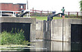
Stanground Lock
Sluice/Lock at exit from Middle Level Navigation towards Peterborough
Image: © Mike Todd
Taken: 23 Jun 2010
0.25 miles