
IMAGES TAKEN NEAR TO
Saturn Drive, PETERBOROUGH, PE2 8GE
Introduction
This page details the photographs taken nearby to Saturn Drive, PE2 8GE by members of the Geograph project.
The Geograph project started in 2005 with the aim of publishing, organising and preserving representative images for every square kilometre of Great Britain, Ireland and the Isle of Man.

There are currently over 7.5m images from over14,400 individuals and you can help contribute to the project by visiting https://www.geograph.org.uk
Image Map
Images are licensed for reuse under creativecommons.org/licenses/by-sa/2.0
Notes
- Clicking on the map will re-center to the selected point.
- The higher the marker number, the further away the image location is from the centre of the postcode.
Image Listing (19 Images Found)
Images are licensed for reuse under creativecommons.org/licenses/by-sa/2.0
Image
Details
Distance
1
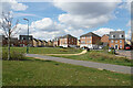
Apollo Avenue
New housing development in Stanground South.
Image: © Bill Boaden
Taken: 8 Apr 2022
0.06 miles
2
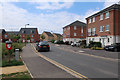
Apollo Avenue, Stanground South
Part of a large expansion of Peterborough.
Image: © Hugh Venables
Taken: 5 May 2019
0.07 miles
3
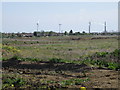
Potential building land or not ?
The view across farmland from the Farcet road to Stanground. The economic decline has put a question mark over the imminent development of some 135 hectares of farmland around Stanground.
The wind turbines in the distance provide electricity for a popular chip and frozen foods company.
http://www.mccain.co.uk/info/press-releases/wind-turbines.aspx
The chimney stacks are at the Saxon brick works and are the last vestiges of brick making in the Peterborough area
Image: © Michael Trolove
Taken: 26 Apr 2009
0.08 miles
4

Drainage channel in Stanground South
A common feature of fenland is also required in housing areas.
Image: © Bill Boaden
Taken: 8 Apr 2022
0.12 miles
5

Apollo Avenue, Stanground South
Part of a large expansion of Peterborough.
Image: © Hugh Venables
Taken: 5 May 2019
0.13 miles

7
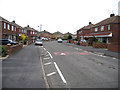
Oakdale Avenue, Stanground, Peterborough
estate perimeter road to the south of Stanground.
Image: © Rodney Burton
Taken: 15 Apr 2006
0.14 miles
8

Drainage channel between new housing
Stanground South, part of a large expansion of Peterborough.
Image: © Hugh Venables
Taken: 5 May 2019
0.15 miles
9

SuDS retention pond, Stanground South, Peterborough
A surface water retention pond. Now a common feature of new housing estates, as legislation belatedly catches up with the need for controlling flood risk by 'SuDS' (Sustainable Drainage Systems)
Image: © Tim Heaton
Taken: 15 Jul 2021
0.16 miles
10
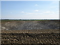
The cut, road construction near Stanground
Land that was growing Wheat and Oilseed Rape until last year is now part of a major infrastructure change to South East Peterborough. The link suggest a rail freight terminal, seven warehouses, two of which will be a quarter of a mile long! Understandably the local residents are not happy.
http://www.peterboroughtoday.co.uk/news/Stanground-residents-set-up-action.3879741.jp
Image: © Michael Trolove
Taken: 26 Apr 2009
0.16 miles