
IMAGES TAKEN NEAR TO
The Briars, HUNTINGDON, PE28 5QF
Introduction
This page details the photographs taken nearby to The Briars, PE28 5QF by members of the Geograph project.
The Geograph project started in 2005 with the aim of publishing, organising and preserving representative images for every square kilometre of Great Britain, Ireland and the Isle of Man.

There are currently over 7.5m images from over14,400 individuals and you can help contribute to the project by visiting https://www.geograph.org.uk
Image Map
Images are licensed for reuse under creativecommons.org/licenses/by-sa/2.0
Notes
- Clicking on the map will re-center to the selected point.
- The higher the marker number, the further away the image location is from the centre of the postcode.
Image Listing (12 Images Found)
Images are licensed for reuse under creativecommons.org/licenses/by-sa/2.0
Image
Details
Distance
1

Ordnance Survey Benchmark - Sawtry, Old School Hall
Ordnance Survey Benchmark (OSBM) used for levelling height above Ordnance Datum (OD).
Height (1966): 14.6213m OD (Newlyn). Mark verified by the Ordnance Survey in 1966. Description: OLD SCHOOL HALL SW FACE 1.2M W ANG. 0.7m above ground. 3rd Order BM.
Context: Image
Image: © N Scott
Taken: 11 Jan 2016
0.15 miles
2

Ordnance Survey Benchmark - Sawtry, Old School Hall
Ordnance Survey Benchmark (OSBM) used for levelling height above Ordnance Datum (OD).
Height (1966): 14.6213m OD (Newlyn). Mark verified by the Ordnance Survey in 1966. Description: OLD SCHOOL HALL SW FACE 1.2M W ANG. 0.7m above ground. 3rd Order BM.
Close-up: Image
Image: © N Scott
Taken: 11 Jan 2016
0.15 miles
3

Old school hall, Sawtry
The former primary school now serves as a community meeting centre with many rooms available for local clubs. Situated in Green End road.
Image: © Michael Trolove
Taken: 12 Nov 2009
0.19 miles
4
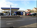
Sawtry garage
A pump attended garage with MOT's and car service. The fuel is a bit pricey but it's a local facility.
Image: © Michael Trolove
Taken: 12 Nov 2009
0.19 miles
5

Sawtry fire station
Sawtry fire station, Green End Road, Sawtry, Cambridgeshire
Image: © Kevin Hale
Taken: 4 Dec 2007
0.19 miles
6

Parish Council office, Sawtry
A large village needing a large office space, may have been the head teachers residence for the old school next door in previous times.
Image: © Michael Trolove
Taken: 12 Nov 2009
0.20 miles
7
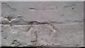
Ordnance Survey Benchmark - Sawtry, The Bell Inn
Ordnance Survey Benchmark (OSBM) used for levelling height above Ordnance Datum (OD).
Height: 7.0013m OD (Newlyn). Mark verified by the Ordnance Survey in 1966. Description: THE BELL INN S ANG SW FACE. 0.4m above ground. 3rd Order BM.
Context: Image
Image: © N Scott
Taken: 11 Jan 2016
0.22 miles
8
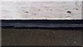
Ordnance Survey Benchmark - Sawtry, The Bell Inn
Ordnance Survey Benchmark (OSBM) used for levelling height above Ordnance Datum (OD).
Height: 7.0013m OD (Newlyn). Mark verified by the Ordnance Survey in 1966. Description: THE BELL INN S ANG SW FACE. 0.4m above ground. 3rd Order BM.
Close-up: Image
Image: © N Scott
Taken: 11 Jan 2016
0.22 miles
9
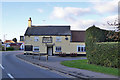
The Bell, Sawtry
On the corner of Green End Road and Blind Lane.
Image: © Robin Webster
Taken: 12 Nov 2017
0.22 miles
10

Westfield Road, Sawtry
Complete with a well grown Monkey Puzzle (Arucaria arucana) tree.
Image: © Michael Trolove
Taken: 12 Nov 2009
0.22 miles