
IMAGES TAKEN NEAR TO
Burwell Reach, PETERBOROUGH, PE2 7ZE
Introduction
This page details the photographs taken nearby to Burwell Reach, PE2 7ZE by members of the Geograph project.
The Geograph project started in 2005 with the aim of publishing, organising and preserving representative images for every square kilometre of Great Britain, Ireland and the Isle of Man.

There are currently over 7.5m images from over14,400 individuals and you can help contribute to the project by visiting https://www.geograph.org.uk
Image Map
Images are licensed for reuse under creativecommons.org/licenses/by-sa/2.0
Notes
- Clicking on the map will re-center to the selected point.
- The higher the marker number, the further away the image location is from the centre of the postcode.
Image Listing (32 Images Found)
Images are licensed for reuse under creativecommons.org/licenses/by-sa/2.0
Image
Details
Distance
1

#439 Oundle Road
There is an OS benchmark Image on the stone wall left of the metal gate incorporating a hare design
Image: © Roger Templeman
Taken: 12 Sep 2018
0.08 miles
2

Benchmark beside gate to #439 Oundle Road
Ordnance Survey cut mark benchmark described on the Bench Mark Database at https://www.bench-marks.org.uk/bm99563
Image: © Roger Templeman
Taken: 12 Sep 2018
0.08 miles
3

The rear to the Botolph Arms
One of two Sam Smith's public houses in Peterborough.
Image: © Ian S
Taken: 13 Feb 2012
0.11 miles
4

Mayflower Approaching Fletton Branch
Preserved B1 steam locomotive Mayflower approaches the Fletton branch on the Nene Valley Railway.
Image: © Mike Bardill
Taken: 30 Apr 2006
0.11 miles
5
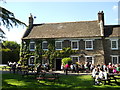
The Botolph Arms, Orton Longueville
Originally built as two separate dwellings in 1749, The Botolph Arms on Oundle Road (named after the nearby St. Botolph's Church) was converted into a pub in 1981. It is currently part of the Sam Smith's chain.
Source: https://whatpub.com/pubs/PET/185/botolph-arms-peterborough
Image: © Paul Bryan
Taken: 25 May 2013
0.12 miles
6

Botolph Arms
One of two Sam Smith's public houses in Peterborough.
Image: © Ian S
Taken: 13 Feb 2012
0.12 miles
7

The beer garden at the Botolph Arms
One of two Sam Smith's public houses in Peterborough.
Image: © Ian S
Taken: 13 Feb 2012
0.12 miles
8

Fletton Branch - Nene Valley Railway
The preserved Nene Valley Railway runs from Wansford into Peterborough. A connection to the east coast main line is provided by the Fletton loop seen here branching away to the right. The line to the terminus in Peterborough is on the left.
Image: © Mike Bardill
Taken: 30 Apr 2006
0.12 miles
9
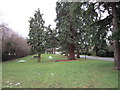
The garden at the Botolph Arms
One of two Sam Smith's public houses in Peterborough.
Image: © Ian S
Taken: 13 Feb 2012
0.13 miles
10

The Botolph Arms
One of two Sam Smith's public houses in Peterborough.
Image: © Ian S
Taken: 13 Feb 2012
0.13 miles