
IMAGES TAKEN NEAR TO
Farriers Court, PETERBOROUGH, PE2 7DY
Introduction
This page details the photographs taken nearby to Farriers Court, PE2 7DY by members of the Geograph project.
The Geograph project started in 2005 with the aim of publishing, organising and preserving representative images for every square kilometre of Great Britain, Ireland and the Isle of Man.

There are currently over 7.5m images from over14,400 individuals and you can help contribute to the project by visiting https://www.geograph.org.uk
Image Map
Images are licensed for reuse under creativecommons.org/licenses/by-sa/2.0
Notes
- Clicking on the map will re-center to the selected point.
- The higher the marker number, the further away the image location is from the centre of the postcode.
Image Listing (16 Images Found)
Images are licensed for reuse under creativecommons.org/licenses/by-sa/2.0
Image
Details
Distance
1
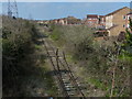
Railway line viewed from Botolph Bridge, Peterborough
Image: © Mat Fascione
Taken: 3 Apr 2016
0.05 miles
2
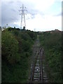
Railway heading north west
Spur line from the East Coast Main Line towards the Nene Valley Railway.
Image: © JThomas
Taken: 23 Aug 2014
0.05 miles
3
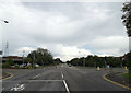
A605 Oundle Road, Orton Longueville
At the junction with Shrewsbury Avenue & Botolph Green
Image: © Geographer
Taken: 25 Jun 2016
0.07 miles
4
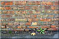
Benchmark on Botolph Bridge, Oundle Road
Ordnance Survey cut mark benchmark described on the Bench Mark Database at https://www.bench-marks.org.uk/bm99556
Image: © Roger Templeman
Taken: 12 Sep 2018
0.08 miles
5

Oundle Road (A605) approaching traffic lights
Heading north east.
Image: © JThomas
Taken: 23 Aug 2014
0.08 miles
6
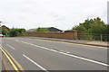
SE parapet of Botolph Bridge, Oundle Road
There is an OS benchmark Image on the parapet about 2m left of its right hand end
Image: © Roger Templeman
Taken: 12 Sep 2018
0.08 miles
7
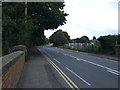
Oundle Road (A605)
Heading north east into Peterborough.
Image: © JThomas
Taken: 23 Aug 2014
0.09 miles
8
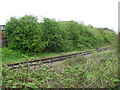
Nene Valley Railway
Fletton Branch.
Image: © Burgess Von Thunen
Taken: 3 May 2012
0.13 miles
9
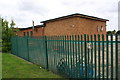
Fence and works building on east side of Shrewsbury Avenue
There is an OS benchmark Image at the junction of the two sections of the building
Image: © Roger Templeman
Taken: 12 Sep 2018
0.16 miles
10

#439 Oundle Road
There is an OS benchmark Image on the stone wall left of the metal gate incorporating a hare design
Image: © Roger Templeman
Taken: 12 Sep 2018
0.17 miles