
IMAGES TAKEN NEAR TO
Eldern, PETERBOROUGH, PE2 5NG
Introduction
This page details the photographs taken nearby to Eldern, PE2 5NG by members of the Geograph project.
The Geograph project started in 2005 with the aim of publishing, organising and preserving representative images for every square kilometre of Great Britain, Ireland and the Isle of Man.

There are currently over 7.5m images from over14,400 individuals and you can help contribute to the project by visiting https://www.geograph.org.uk
Image Map
Images are licensed for reuse under creativecommons.org/licenses/by-sa/2.0
Notes
- Clicking on the map will re-center to the selected point.
- The higher the marker number, the further away the image location is from the centre of the postcode.
Image Listing (14 Images Found)
Images are licensed for reuse under creativecommons.org/licenses/by-sa/2.0
Image
Details
Distance
1
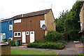
Junction of footpaths in Lythemere
Ordnance Survey documents indicate that in 1980 a benchmark levelled at 16.160 m above Newlyn Datum was verified on the side of the right hand house at its front corner. An attempt to find the mark was thwarted by the bushes growing on the corner. See www.bench-marks.org.uk/88668
Image: © Roger Templeman
Taken: 10 Sep 2019
0.15 miles
2
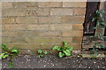
Benchmark on #27 Shortfen
Ordnance Survey cut mark benchmark described on the Bench Mark Database at www.bench-marks.org.uk/bm111526
Image: © phil Richards
Taken: 10 Sep 2019
0.16 miles
3
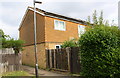
Path alongside #27 Shortfen
There is an OS benchmark Image on the left hand side of the house at the junction with its wooden fence
Image: © phil Richards
Taken: 10 Sep 2019
0.16 miles
4

Benchmark on NW parapet of Malborne Way bridge over subway
Ordnance Survey rivet benchmark described on the Bench Mark Database at www.bench-marks.org.uk/bm88669
Image: © phil Richards
Taken: 10 Sep 2019
0.18 miles
5

Parapet of bridge on NW side of Malborne Way taking the road over a subway
There is a benchmark Image on the top of the concrete base of the parapet near its right hand end
Image: © phil Richards
Taken: 10 Sep 2019
0.18 miles
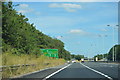
8
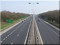
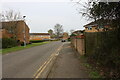
Looking to the east from the new pedestrian bridge
Peterborough's parkway system (ring road) has seen long term road works at this point with a third lane added to each carriageway to cope with increased traffic flows in and out of Peterborough.
Image: © Michael Trolove
Taken: 21 Mar 2009
0.22 miles
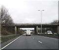
10
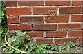
Benchmark on #11 The Crescent
Ordnance Survey cut mark benchmark described on the Bench Mark Database at www.bench-marks.org.uk/bm88670
Image: © phil Richards
Taken: 10 Sep 2019
0.23 miles