
IMAGES TAKEN NEAR TO
Benyon Grove, PETERBOROUGH, PE2 5HP
Introduction
This page details the photographs taken nearby to Benyon Grove, PE2 5HP by members of the Geograph project.
The Geograph project started in 2005 with the aim of publishing, organising and preserving representative images for every square kilometre of Great Britain, Ireland and the Isle of Man.

There are currently over 7.5m images from over14,400 individuals and you can help contribute to the project by visiting https://www.geograph.org.uk
Image Map
Images are licensed for reuse under creativecommons.org/licenses/by-sa/2.0
Notes
- Clicking on the map will re-center to the selected point.
- The higher the marker number, the further away the image location is from the centre of the postcode.
Image Listing (15 Images Found)
Images are licensed for reuse under creativecommons.org/licenses/by-sa/2.0
Image
Details
Distance
2
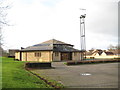
Orton Malborne: St Luke's Roman Catholic Church
It is a source of wonderment to the photographer that every church in the country with a website seems to have been first on the scene to grab a URL with a suitable address! How many St Luke's are there in the country? Anyway here's this St Luke's website http://www.saintlukesparish.org.uk/
Image: © Nigel Cox
Taken: 21 Jan 2012
0.10 miles
4
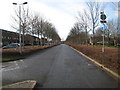
Orton Malborne: The Busway
This is the route of the "citi 1" bus from Peterborough city centre to Orton Wistow.
Image: © Nigel Cox
Taken: 21 Jan 2012
0.12 miles
5
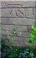
Benchmark on #74 Blackmead
Ordnance Survey cut mark benchmark described on the Bench Mark Database at www.bench-marks.org.uk/bm88667
Image: © phil Richards
Taken: 10 Sep 2019
0.14 miles
6
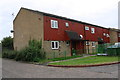
Nos.72-75 Blackmead
There is an OS benchmark Image on the near corner, left hand face, of the block of houses
Image: © phil Richards
Taken: 10 Sep 2019
0.14 miles
7
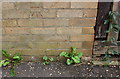
Benchmark on #27 Shortfen
Ordnance Survey cut mark benchmark described on the Bench Mark Database at www.bench-marks.org.uk/bm111526
Image: © phil Richards
Taken: 10 Sep 2019
0.19 miles
8
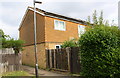
Path alongside #27 Shortfen
There is an OS benchmark Image on the left hand side of the house at the junction with its wooden fence
Image: © phil Richards
Taken: 10 Sep 2019
0.19 miles
9
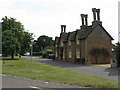
Houses by the village green, Orton Longueville
Image: © Peter Whatley
Taken: 27 Jul 2013
0.20 miles
10

Houses of Clayton
There is an OS benchmark Image on the side of the nearest house, behind the shrub
Image: © phil Richards
Taken: 10 Sep 2019
0.21 miles