
IMAGES TAKEN NEAR TO
Hundred Foot Bank, WISBECH, PE14 9TL
Introduction
This page details the photographs taken nearby to Hundred Foot Bank, PE14 9TL by members of the Geograph project.
The Geograph project started in 2005 with the aim of publishing, organising and preserving representative images for every square kilometre of Great Britain, Ireland and the Isle of Man.

There are currently over 7.5m images from over14,400 individuals and you can help contribute to the project by visiting https://www.geograph.org.uk
Image Map
Images are licensed for reuse under creativecommons.org/licenses/by-sa/2.0
Notes
- Clicking on the map will re-center to the selected point.
- The higher the marker number, the further away the image location is from the centre of the postcode.
Image Listing (45 Images Found)
Images are licensed for reuse under creativecommons.org/licenses/by-sa/2.0
Image
Details
Distance
1

Bridleway along Ouse Washes
Past Tall Pines, formerly a Church of England free school known as the "Mission School", see http://www.welney.org.uk/suspension-bridge/susp-br.htm
Image: © Hugh Venables
Taken: 3 Dec 2011
0.04 miles
2

Road north from Suspension Bridge
Apart from at the junction for the bridge, the road is at the level of the fields, some way below the level of the river.
Image: © Colin Bell
Taken: 5 Apr 2008
0.11 miles
3

Ouse Washes
Still dry after a very dry autumn.
Image: © Hugh Venables
Taken: 3 Dec 2011
0.11 miles
4
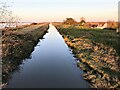
The New Bedford River at Suspension Bridge - The Ouse Washes
...
Image: © Richard Humphrey
Taken: 22 Nov 2020
0.12 miles
5

Ouse Washes
Looking into the washes from Suspension Bridge. The right-hand bank (and a matching one the other side) hold water pumped into the washes to drain the surrounding Fens (which would otherwise be a very large swamp).
Image: © Hugh Venables
Taken: 25 Oct 2008
0.13 miles
6

Early winter flooding near Suspension Bridge - The Ouse Washes
...
Image: © Richard Humphrey
Taken: 22 Nov 2020
0.15 miles
7

Shallow flood water - The Ouse Washes
Following unusually heavy rainfall in April the washlands have remained flooded into May this year
Image: © Richard Humphrey
Taken: 6 May 2018
0.15 miles
8

The Hundred Foot Drain at Suspension Bridge near Welney
Also known as the New Bedford River. The suspension bridge that once crossed the river here has been replaced with a single span bridge but the cluster of houses are still called Suspension Bridge, see http://www.welney.org.uk/suspension-bridge/susp-br.htm
Image: © Richard Humphrey
Taken: 17 Jan 2013
0.15 miles
9

The New Bedford River - The Ouse Washes near Welney
...
Image: © Richard Humphrey
Taken: 17 Jan 2013
0.15 miles
10

New Bedford River
The Hereward Way finally finds itself crossing the New Bedford River after wandering many miles in basically the wrong direction. It spans the watercourse along with the A1011, before heading for the village of Welney.
Image: © Chris Heaton
Taken: 16 Aug 2024
0.16 miles