
IMAGES TAKEN NEAR TO
Panswell Lane, WISBECH, PE13 5JS
Introduction
This page details the photographs taken nearby to Panswell Lane, PE13 5JS by members of the Geograph project.
The Geograph project started in 2005 with the aim of publishing, organising and preserving representative images for every square kilometre of Great Britain, Ireland and the Isle of Man.

There are currently over 7.5m images from over14,400 individuals and you can help contribute to the project by visiting https://www.geograph.org.uk
Image Map
Images are licensed for reuse under creativecommons.org/licenses/by-sa/2.0
Notes
- Clicking on the map will re-center to the selected point.
- The higher the marker number, the further away the image location is from the centre of the postcode.
Image Listing (14 Images Found)
Images are licensed for reuse under creativecommons.org/licenses/by-sa/2.0
Image
Details
Distance
2

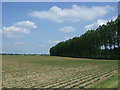
Panswell Lane heading towards Barton Road
Image: © Richard Humphrey
Taken: 16 Oct 2009
0.09 miles
3

Willow trees near Barratt's Bridge
Image: © Richard Humphrey
Taken: 23 Jan 2023
0.10 miles
4

Panswell Lane
Heading south east towards Wisbech.
Image: © JThomas
Taken: 17 May 2014
0.11 miles

6
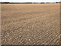
The aptly named Flatmoor Field near Wisbech St Mary
After weeks of heavy rain with many fields partially flooded farmers are at last able to cultivate and drill their crops thanks to the last 2 weeks being dry, sunny and windy.
Image: © Richard Humphrey
Taken: 2 Apr 2020
0.14 miles
7

Diverging dikes on Flatmoor Field near Wisbech St Mary
The field to the right of the dike is shown as orchard on some Ordnance Survey maps. Clearly it has been removed and the land is being used for growing a cereal crop this year. The tree stump is one of many which would once have surrounded the former orchard on this fenland lane called Panswell Lane
Image: © Richard Humphrey
Taken: 2 Apr 2020
0.19 miles
8

The remains of a footbridge over White Engine Drain
Connecting Leverington Common to Garden Lane between Wisbech St Mary and Leverington
Image: © Richard Humphrey
Taken: 2 Apr 2020
0.19 miles

10

Farmland track between Station Road and Panswell Lane
Unfortunately this track has been blocked by a pile of old trees near the rear of The Manor House in Wisbech St Mary thus preventing a circular walk around Nymandole Field
Image: © Richard Humphrey
Taken: 2 Apr 2020
0.23 miles