IMAGES TAKEN NEAR TO
The Bank, WISBECH, PE13 4JD
Introduction
This page details the photographs taken nearby to The Bank, PE13 4JD by members of the Geograph project.
The Geograph project started in 2005 with the aim of publishing, organising and preserving representative images for every square kilometre of Great Britain, Ireland and the Isle of Man.

There are currently over 7.5m images from over14,400 individuals and you can help contribute to the project by visiting https://www.geograph.org.uk
Image Map
Images are licensed for reuse under creativecommons.org/licenses/by-sa/2.0
Notes
- Clicking on the map will re-center to the selected point.
- The higher the marker number, the further away the image location is from the centre of the postcode.
Image Listing (20 Images Found)
Images are licensed for reuse under creativecommons.org/licenses/by-sa/2.0
Image
Details
Distance
2
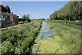
North Level Main Drain
This drain, constructed in the 1830s to the designs of John Rennie.
We are looking downstream in the main direction of flow, when flow there is. The presence of duckweed shows how static the water has been for the last few months.
Image: © Bob Harvey
Taken: 16 Jun 2023
0.12 miles
3
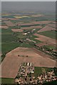
Parson Drove to Cloughs Cross: aerial 2018
For Cloughs Cross see also Image
Image: © Chris
Taken: 6 May 2018
0.18 miles
6
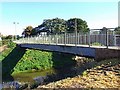
Swan Footbridge
The pipe underneath is for mains water.
Image: © Tony Bennett
Taken: 9 Oct 2008
0.20 miles
8
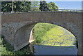
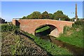
The Swan Bridge
Almost certainly named for the nearby Inn, this bridge crosses the North Level Main Drain, the master leet for the North Level District Internal Drainage Board.
The bridge dates from 1832, a period of intensive investment in the fens with the change from wind to steam drainage. This was the same period of drainage improvment under John Rennie when the nearby Clough Bridge was built (Image). This when the North Level Main Drain was constructed, greatly improving the agriculture hereabouts.
Image: © Bob Harvey
Taken: 16 Jun 2023
0.21 miles
9
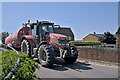
On the bridge
A tractor towing a slurry trailer.
The trailer is a Redrock tandem axle slurry tanker. The tractor a Massey Fergusson 7618.
Image: © Bob Harvey
Taken: 16 Jun 2023
0.21 miles