
The Swan Bridge
Introduction
The photograph on this page of The Swan Bridge by Bob Harvey as part of the Geograph project.
The Geograph project started in 2005 with the aim of publishing, organising and preserving representative images for every square kilometre of Great Britain, Ireland and the Isle of Man.

There are currently over 7.5m images from over 14,400 individuals and you can help contribute to the project by visiting https://www.geograph.org.uk
The Swan Bridge
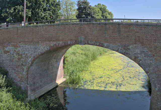
Image: © Bob Harvey Taken: 16 Jun 2023
Almost certainly named for the nearby Inn, this bridge crosses the North Level Main Drain, the master leet for the North Level District Internal Drainage Board. The bridge dates from 1832, a period of intensive investment in the fens with the change from wind to steam drainage. This was the same period of drainage improvment under John Rennie when the nearby Clough Bridge was built (Image). This when the North Level Main Drain was constructed, greatly improving the agriculture hereabouts.
Images are licensed for reuse under creativecommons.org/licenses/by-sa/2.0
Image Location

Latitude
52.65649
Longitude
0.023104