
IMAGES TAKEN NEAR TO
Inhams Close, WISBECH, PE13 4HS
Introduction
This page details the photographs taken nearby to Inhams Close, PE13 4HS by members of the Geograph project.
The Geograph project started in 2005 with the aim of publishing, organising and preserving representative images for every square kilometre of Great Britain, Ireland and the Isle of Man.

There are currently over 7.5m images from over14,400 individuals and you can help contribute to the project by visiting https://www.geograph.org.uk
Image Map
Images are licensed for reuse under creativecommons.org/licenses/by-sa/2.0
Notes
- Clicking on the map will re-center to the selected point.
- The higher the marker number, the further away the image location is from the centre of the postcode.
Image Listing (9 Images Found)
Images are licensed for reuse under creativecommons.org/licenses/by-sa/2.0
Image
Details
Distance


5

The remains of Murrow Station near Wisbech
Once part of the GE & GN Joint Line from Spalding to March which closed in November 1982.
Image: © Richard Humphrey
Taken: 20 Apr 2011
0.22 miles

7

Across the fields to the remains of Murrow West station
View SW, across the course of the former M&GN Joint Railway: ex-GN&GE Joint main line March (to left) - (to right) Spalding - Sleaford - Lincoln - Doncaster. The station was closed 6/7/53 and following the closure of the principal Whitemoor Marshalling Yard at March, the March - Spalding section of line was closed 28/11/82. Until closed 2/3/59, there had been an unusual level-crossing of this line with the Peterborough North - Sutton Bridge section of the M&GN Railway, to the left here, at Murrow East station. (Both stations were called plain 'Murrow' until 27/9/48, i.e. after Nationalisation).
Image: © Ben Brooksbank
Taken: 15 Jul 2003
0.24 miles
8

Primitive Methodist School Room, Murrow
Dates 1908.
Image: © Jonathan Thacker
Taken: 8 Jul 2024
0.24 miles
9
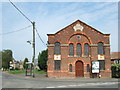
Primitive Methodists Chapel in Murrow near Wisbech
Built in 1875 on the eastern side of The Bank
Image: © Richard Humphrey
Taken: 6 May 2011
0.25 miles