IMAGES TAKEN NEAR TO
Station Road, WISBECH, PE13 4HA
Introduction
This page details the photographs taken nearby to Station Road, PE13 4HA by members of the Geograph project.
The Geograph project started in 2005 with the aim of publishing, organising and preserving representative images for every square kilometre of Great Britain, Ireland and the Isle of Man.

There are currently over 7.5m images from over14,400 individuals and you can help contribute to the project by visiting https://www.geograph.org.uk
Image Map
Images are licensed for reuse under creativecommons.org/licenses/by-sa/2.0
Notes
- Clicking on the map will re-center to the selected point.
- The higher the marker number, the further away the image location is from the centre of the postcode.
Image Listing (25 Images Found)
Images are licensed for reuse under creativecommons.org/licenses/by-sa/2.0
Image
Details
Distance
1
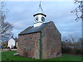
The Cage in Parson Drove, Cambridgeshire
A grade II listed building which has been used for all sorts of things since it was built in 1829 - Animal pen - Fire station - Police station - Prison - Store Visitors centre. See http://www.parsondrove.net/cage.php
Image: © Richard Humphrey
Taken: 27 Jan 2013
0.02 miles
2
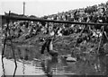
Parson Drove village fete 1959
The pillow fight on the slippery pole was one of the main attractions at this annual fete with hundreds of people watching from the banks of the North Level Drain near Swan Bridge. The old telegraph pole was heavily greased and the two opponents straddled the pole facing each other and proceeded to have a pillow fight with hessian sacks full of waterlogged straw. The objective was to knock your opponent into the drain. On this particular occasion both men ended up in the water but my father, Hugh Humphrey, was deemed to be the loser as he hit the water first. The spire of The Cage, https://www.geograph.org.uk/photo/3316947, is just visible next to the trees which enabled me to locate the photo, along with a distant memory. At more recent fetes, presumably due to our wonderful Health & Safety laws, this contest was fought out over an inflated pool on the village green.
Image: © The Humphrey family archive
Taken: 31 Aug 1959
0.03 miles
3
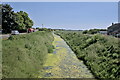
The North Level Main Drain
Constructed in the 1830s to designs by John Rennie. It drains the area of the North Level District Internal Drainage Board Northwards, joining the River Nene at Tydd Gote, downstream of Wisbech.
Image: © Bob Harvey
Taken: 16 Jun 2023
0.04 miles
4
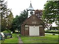
The Cage, Parson Drove
Originally a fire station and reception centre for prisoners of war.
Image: © Tony Bennett
Taken: 24 May 2006
0.04 miles
5
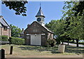
The Cage
Built as a village lock-up in the 19th century , and later converted to house a fire engine (the roller doors are far more suitable for that than to restrain miscreants). In the second world war it again housed the police, but it is now a local history display and visitors centre, open by prior appointment or otherwise intermittently.
This is a grade II listed building - see https://historicengland.org.uk/listing/the-list/list-entry/1310221?section=official-list-entry. A local website (https://www.parsondrove.net/john-peck-the-cage/ ), quoting locally famous diarist John Peck gives the date of construction as 1829, the Historic England listing gives it as 1816, based on an inscription on the gable. I managed an unclear photograph of the heavily weathered datestone, which does read mdcccxvi (1816). The only reason to give credence to the diary date of 1829, is that John Peck paid for the construction, and the arrival of the navigators to construct the North Level Main Drain, and the redevelopment of the Inn, must have been around then. And Yet, and yet, Peck was appointed parish constable in 1816, so his interest in local law and order coincides with the earlier date, the one cast in stone.
The clock tower was added for Queen Victoria's Diamond Jubilee in 1897. (Image).
Image: © Bob Harvey
Taken: 16 Jun 2023
0.04 miles
6
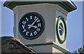
Clock of 1897
A clock, celebrating Queen Victoria's Diamond Jubilee in 1897, atop Image Interestingly the legend to the celebration replaces numbers on the clock's chapter.
The clock is mentioned in the buildings listing at https://historicengland.org.uk/listing/the-list/list-entry/1310221?section=official-list-entry .
Image: © Bob Harvey
Taken: 16 Jun 2023
0.04 miles
8
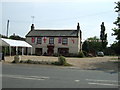
Samuel Pepys slept here 17/9/1663 - The Swan Inn
One of 3 public houses still serving the village of Parson Drove, decked out as part of the national celebrations to mark the wedding of Prince William to Catherine Middleton, now Duke and Duchess of Cambridge. In September 1663 the diarist Samuel Pepys slept at the inn and was none to complimentary about it or the surrounding fens, see http://www.british-history.ac.uk/report.aspx?compid=21917
Image: © Richard Humphrey
Taken: 6 May 2011
0.06 miles
9
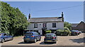
The Swan Inn
A typical fenland pub, fortunately surviving, and handling the needs of the local community. See also Image
Recommended.
It is odd that this is not a listed building as it has a considerable history, dating from at least 1541. Samual Pepys, who visited Parson Drove on 17 and 18 September 1663, described it as a ‘heathen place’ where he had to sleep in a ‘sad, cold, stony chamber in a miserable inn’. He did, however, manage a minor seduction of the maid. He was talking about the Swan Inn. The current fabric dates, like the nearby drainage work, to the early 1830s. In 1834 it was the property of a brewer called Charles Boucher, who rebuilt it almost entirely.
Image: © Bob Harvey
Taken: 16 Jun 2023
0.06 miles