
The Cage
Introduction
The photograph on this page of The Cage by Bob Harvey as part of the Geograph project.
The Geograph project started in 2005 with the aim of publishing, organising and preserving representative images for every square kilometre of Great Britain, Ireland and the Isle of Man.

There are currently over 7.5m images from over 14,400 individuals and you can help contribute to the project by visiting https://www.geograph.org.uk
The Cage
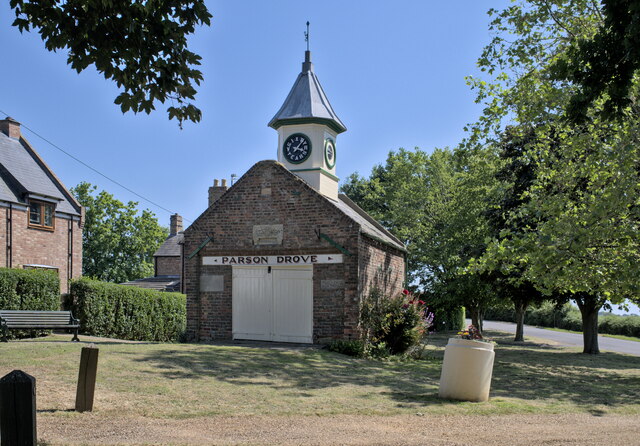
Image: © Bob Harvey Taken: 16 Jun 2023
Built as a village lock-up in the 19th century , and later converted to house a fire engine (the roller doors are far more suitable for that than to restrain miscreants). In the second world war it again housed the police, but it is now a local history display and visitors centre, open by prior appointment or otherwise intermittently. This is a grade II listed building - see https://historicengland.org.uk/listing/the-list/list-entry/1310221?section=official-list-entry. A local website (https://www.parsondrove.net/john-peck-the-cage/ ), quoting locally famous diarist John Peck gives the date of construction as 1829, the Historic England listing gives it as 1816, based on an inscription on the gable. I managed an unclear photograph of the heavily weathered datestone, which does read mdcccxvi (1816). The only reason to give credence to the diary date of 1829, is that John Peck paid for the construction, and the arrival of the navigators to construct the North Level Main Drain, and the redevelopment of the Inn, must have been around then. And Yet, and yet, Peck was appointed parish constable in 1816, so his interest in local law and order coincides with the earlier date, the one cast in stone. The clock tower was added for Queen Victoria's Diamond Jubilee in 1897. (Image).
Images are licensed for reuse under creativecommons.org/licenses/by-sa/2.0
Image Location

Latitude
52.656072
Longitude
0.023942