
IMAGES TAKEN NEAR TO
Guthram, BOURNE, PE10 0BD
Introduction
This page details the photographs taken nearby to PE10 0BD by members of the Geograph project.
The Geograph project started in 2005 with the aim of publishing, organising and preserving representative images for every square kilometre of Great Britain, Ireland and the Isle of Man.

There are currently over 7.5m images from over14,400 individuals and you can help contribute to the project by visiting https://www.geograph.org.uk
Image Map
Images are licensed for reuse under creativecommons.org/licenses/by-sa/2.0
Notes
- Clicking on the map will re-center to the selected point.
- The higher the marker number, the further away the image location is from the centre of the postcode.
Image Listing (34 Images Found)
Images are licensed for reuse under creativecommons.org/licenses/by-sa/2.0
Image
Details
Distance


3
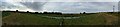
River Glen
Taken from the south bank, opposite Guthram Gowt. Access via the visitor centre at Willow Tree Fen, or along the Macmillan Way along the bank.
The Glen is embanked above the fen all the way from Kates Bridge on the A15 to the sluice at Surfleet where it joins the Welland.
If the power lines look as though they are arching upwards, they aren't. There was a strong easterly blowing which produced ripples on the river that gave the illusion it was flowing the wrong way.
Image: © Bob Harvey
Taken: 18 Aug 2016
0.06 miles
4
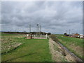
Engine Peninsula
General view of the engine peninsula and rainfall telemetry station.
The drain in the right foreground has come under the road from Image It continues straight on into the South Forty Foot Drain. The engine would have stood in the immediate foreground, lifting the water in that drain into the South Forty Foot.
Image: © Bob Harvey
Taken: 5 Apr 2010
0.06 miles

6
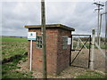
Guthram Gowt rainfall monitoring station telemetry hut
The building and fence at the rainfall station. The sign next to the gate carries the logo of the long-forgotten National Rivers Authority
Image: © Bob Harvey
Taken: 5 Apr 2010
0.08 miles
7
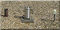
Guthram Gowt rainfall monitoring station rain gauge instrument
Inside the compound is a gravel paved area and this rainfall gauge
Image: © Bob Harvey
Taken: 5 Apr 2010
0.08 miles
8

Guthram Gowt rainfall monitoring station telemetry hut sign
Environment agency sign on the hut.
Image: © Bob Harvey
Taken: 5 Apr 2010
0.08 miles
9

River Glen at Guthram Gowt Bridge: aerial 2014
Image: © Chris
Taken: 2 Jul 2014
0.09 miles
10

Cow next to the River Glen
On the south riverbank near the Willow Tree Fen Nature Reserve.
Image: © Mat Fascione
Taken: 16 Apr 2014
0.10 miles