
River Glen
Introduction
The photograph on this page of River Glen by Bob Harvey as part of the Geograph project.
The Geograph project started in 2005 with the aim of publishing, organising and preserving representative images for every square kilometre of Great Britain, Ireland and the Isle of Man.

There are currently over 7.5m images from over 14,400 individuals and you can help contribute to the project by visiting https://www.geograph.org.uk
River Glen
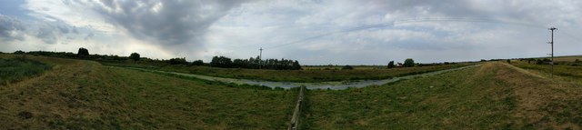
Image: © Bob Harvey Taken: 18 Aug 2016
Taken from the south bank, opposite Guthram Gowt. Access via the visitor centre at Willow Tree Fen, or along the Macmillan Way along the bank. The Glen is embanked above the fen all the way from Kates Bridge on the A15 to the sluice at Surfleet where it joins the Welland. If the power lines look as though they are arching upwards, they aren't. There was a strong easterly blowing which produced ripples on the river that gave the illusion it was flowing the wrong way.
Images are licensed for reuse under creativecommons.org/licenses/by-sa/2.0
Image Location

Latitude
52.787421
Longitude
-0.261788