IMAGES TAKEN NEAR TO
Clyde Square, GREENOCK, PA15 9SL

Introduction

This page details the photographs taken nearby to Clyde Square, PA15 9SL by members of the Geograph project.

The Geograph project started in 2005 with the aim of publishing, organising and preserving representative images for every square kilometre of Great Britain, Ireland and the Isle of Man.

There are currently over 7.5m images from over14,400 individuals and you can help contribute to the project by visiting https://www.geograph.org.uk

Image Map


Images are licensed for reuse under creativecommons.org/licenses/by-sa/2.0
Notes
  • Clicking on the map will re-center to the selected point.
  • The higher the marker number, the further away the image location is from the centre of the postcode.

Image Listing (797 Images Found)

Images are licensed for reuse under creativecommons.org/licenses/by-sa/2.0
  • ...
Image
Details
Distance
1
Greenock Municipal Buildings
The Victoria Tower atop these buildings dominates the entire Greenock skyline, standing as it does at 245 feet tall.
Image: © Stephen Sweeney Taken: 5 Oct 2008
0.00 miles
2
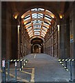
Greenock Municipal Buildings carriageway
Looking in to the recently renovated carriageway from the Wallace Place entrance.
Image: © Thomas Nugent Taken: 8 Oct 2022
0.00 miles
3
Greenock Town Hall undercroft
The woodwork and glazing in the roof were recently replaced.
Image: © Thomas Nugent Taken: 8 Nov 2022
0.01 miles
4
Drummer's Close
Plaque at the entrance to the close Image
Image: © Thomas Nugent Taken: 7 Jan 2008
0.01 miles
5
Drummer's Close
Between the Municipal Buildings and the James Watt memorial building. See the plaque here Image
Image: © Thomas Nugent Taken: 7 Jan 2008
0.01 miles
6
Greenock Municipal Buildings
Category A Listed http://portal.historicenvironment.scot/designation/LB34122 . Undergoing some renovation. Viewed across the Bullring car park.
Image: © Thomas Nugent Taken: 29 Dec 2016
0.01 miles
7
Greenock Municipal Buildings
This part of the building, facing the A8, is disused and awaiting restoration.
Image: © Thomas Nugent Taken: 7 Jan 2008
0.01 miles
8
Greenock Municipal Buildings
The Wallace Place end of the road through the municipal buildings. The other end is at Cathcart Square. A Category A Listed building http://data.historic-scotland.gov.uk/pls/htmldb/f?p=2200:15:0::::BUILDING:34122 .
Image: © Thomas Nugent Taken: 23 Aug 2014
0.01 miles
9
The Victoria Tower
The tower is on the Category A Listed Greenock Municipal Buildings http://data.historic-scotland.gov.uk/pls/htmldb/f?p=2200:15:0::::BUILDING:34122 .
Image: © Thomas Nugent Taken: 3 Jan 2018
0.01 miles
10
Greenock Town hall main facade
A grand building.The red brick area is known as Cowan's Corner and housed shops which were demolished during the 1941 Greenock blitz. The corner now houses the Sculpture Garden Image Renovation work has since covered the exposed brickwork Image Further changes were made in 2012 Image
Image: © Thomas Nugent Taken: 27 Jan 2007
0.01 miles
  • ...