IMAGES TAKEN NEAR TO
Cartsburn Street, GREENOCK, PA15 4UG

Introduction

This page details the photographs taken nearby to Cartsburn Street, PA15 4UG by members of the Geograph project.

The Geograph project started in 2005 with the aim of publishing, organising and preserving representative images for every square kilometre of Great Britain, Ireland and the Isle of Man.

There are currently over 7.5m images from over14,400 individuals and you can help contribute to the project by visiting https://www.geograph.org.uk

Image Map


Images are licensed for reuse under creativecommons.org/licenses/by-sa/2.0
Notes
  • Clicking on the map will re-center to the selected point.
  • The higher the marker number, the further away the image location is from the centre of the postcode.

Image Listing (422 Images Found)

Images are licensed for reuse under creativecommons.org/licenses/by-sa/2.0
  • ...
Image
Details
Distance
1
Concrete works
This is a ready-mix concrete plant owned by Tarmac Topmix. The silo contains cement which is delivered from a Cement Works by pressure tanker and is blown into the silo through the pipes to the right. At the bottom of the silo (practically hidden by the tree) is a weigher for dispensing the materials, and beneath it a pan mixer which discharges into ready-mix trucks. The hopper in the centre has three bins (numbered) which contain different sizes of aggregate. The bins are topped up by the conveyor which can be swung across to feed them in turn. The conveyor is fed by the feeder to the right which is presumably loaded with a front-loader that picks up from the piles in the yard.
Image: © Thomas Nugent Taken: 9 Nov 2007
0.03 miles
2
Carts Burn
Almost hidden from view on the north side of Ingleston Street.
Image: © Thomas Nugent Taken: 4 Nov 2019
0.03 miles
3
Ingleston Street
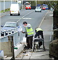
A new barrier is being erected to prevent traffic from crashing through a bridge parapet into the Carts Burn below.
Image: © Thomas Nugent Taken: 9 Nov 2007
0.04 miles
4
Concrete plant
This is Tarmac Ltd's Greenock plant, at the junction of Orchard Street (foreground) and Ingleston Road (left). Compare their Dumbarton plant: Image
Image: © Lairich Rig Taken: 25 Sep 2010
0.04 miles
5
Former concrete plant on Orchard Street
See the scene in 2007 when the plant was in operation Image
Image: © Thomas Nugent Taken: 5 Nov 2020
0.04 miles
6
Former concrete plant on Orchard Street
See the scene in 2007 when the plant was in operation Image
Image: © Thomas Nugent Taken: 5 Nov 2020
0.04 miles
7
Belville Street towerblocks
The concrete plant at Orchard Street is on the left. The towerblocks are being prepared for demolition by explosives.
Image: © Thomas Nugent Taken: 1 Mar 2013
0.05 miles
8
Flood channel on Cartsburn Street
The Carts Burn is culverted at this point and this channel was constructed to control the flow of excess water in the event that the culvert became overwhelmed during flood conditions. An Automated Self-Cleaning Trash Screen was installed at the entrance to the culvert (at the grey fence in the distance) in January 2015 to reduce the risk of such flooding in future (flooding last occurred here in 2011). Further down Cartsburn, the pavement on the west side of the street has been modified to act as further flood channel, with a large drain at its end Image PDF document about the Cartsburn Automated Self-Cleaning Trash Screen https://www.transport.gov.scot/media/4023/inverclyde-council-cartsburn-automated-trash-screen-report.pdf .
Image: © Thomas Nugent Taken: 5 Nov 2020
0.05 miles
9
Orchard Brae
The steep section of Orchard Street.
Image: © Thomas Nugent Taken: 5 Nov 2020
0.05 miles
10
Mobile shop
On John Street. Looks like it used to be "Jim's Fresh Fish" before being repainted. See also Image
Image: © Thomas Nugent Taken: 9 Nov 2007
0.05 miles
  • ...