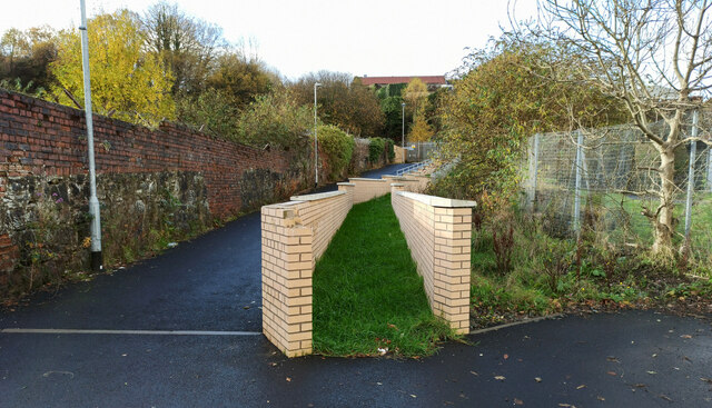
Flood channel on Cartsburn Street
Introduction
The photograph on this page of Flood channel on Cartsburn Street by Thomas Nugent as part of the Geograph project.
The Geograph project started in 2005 with the aim of publishing, organising and preserving representative images for every square kilometre of Great Britain, Ireland and the Isle of Man.
There are currently over 7.5m images from over 14,400 individuals and you can help contribute to the project by visiting https://www.geograph.org.uk

Image: © Thomas Nugent Taken: 5 Nov 2020
The Carts Burn is culverted at this point and this channel was constructed to control the flow of excess water in the event that the culvert became overwhelmed during flood conditions. An Automated Self-Cleaning Trash Screen was installed at the entrance to the culvert (at the grey fence in the distance) in January 2015 to reduce the risk of such flooding in future (flooding last occurred here in 2011). Further down Cartsburn, the pavement on the west side of the street has been modified to act as further flood channel, with a large drain at its end Image PDF document about the Cartsburn Automated Self-Cleaning Trash Screen https://www.transport.gov.scot/media/4023/inverclyde-council-cartsburn-automated-trash-screen-report.pdf .

