IMAGES TAKEN NEAR TO
Fernhill Close, THAME, OX9 2NA
Introduction
This page details the photographs taken nearby to Fernhill Close, OX9 2NA by members of the Geograph project.
The Geograph project started in 2005 with the aim of publishing, organising and preserving representative images for every square kilometre of Great Britain, Ireland and the Isle of Man.

There are currently over 7.5m images from over14,400 individuals and you can help contribute to the project by visiting https://www.geograph.org.uk
Image Map
Images are licensed for reuse under creativecommons.org/licenses/by-sa/2.0
Notes
- Clicking on the map will re-center to the selected point.
- The higher the marker number, the further away the image location is from the centre of the postcode.
Image Listing (42 Images Found)
Images are licensed for reuse under creativecommons.org/licenses/by-sa/2.0
Image
Details
Distance
1
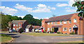
Houses along Albury View
Albury View is the name of the street.
Albury village is a couple of fields away.
I expect you can see it from the back window of these houses.
Image: © Des Blenkinsopp
Taken: 1 Jun 2020
0.01 miles
2
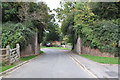
Side walls of bridge for dismantled railway over Albury View
Image: © Roger Templeman
Taken: 8 Oct 2013
0.04 miles
4
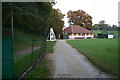
Tiddington Cricket Pavilion
Tiddington Cricket Pavilion with the Nets by the old railway embankment
Image: © Shaun Ferguson
Taken: 4 Nov 2007
0.08 miles
5
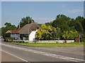
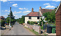
Houses on A418 at Tiddington
View from the end of the road to Ickford.
Image: © David Hawgood
Taken: 2 Jun 2006
0.08 miles
6
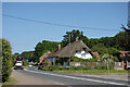
Thame Road, Tiddington
The busy A418, the main road through the village.
Image: © Des Blenkinsopp
Taken: 2 Jun 2023
0.10 miles
7
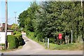
School Lane in Tiddington
The Oxfordshire Way runs along School Lane.
Image: © Steve Daniels
Taken: 1 Aug 2011
0.10 miles
8
Albury View, Tiddington
The road is Albury View. The tree on the right is a red horse chestnut, which is a variant of the more usual white horse chestnut.
Image: © David Hawgood
Taken: 2 Jun 2006
0.11 miles
9
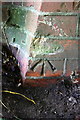
Benchmark on railway bridge on minor road to Albury
Ordnance Survey cut mark benchmark described on the Bench Mark Database at http://www.bench-marks.org.uk/bm52179
Image: © Roger Templeman
Taken: 24 Oct 2013
0.11 miles
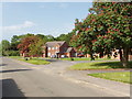
10
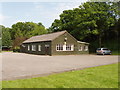
Tiddington Village Hall
View from the adjacent sports field.
Image: © David Hawgood
Taken: 2 Jun 2006
0.12 miles