IMAGES TAKEN NEAR TO
Annesley Close, KIDLINGTON, OX5 3DG
Introduction
This page details the photographs taken nearby to Annesley Close, OX5 3DG by members of the Geograph project.
The Geograph project started in 2005 with the aim of publishing, organising and preserving representative images for every square kilometre of Great Britain, Ireland and the Isle of Man.

There are currently over 7.5m images from over14,400 individuals and you can help contribute to the project by visiting https://www.geograph.org.uk
Image Map
Images are licensed for reuse under creativecommons.org/licenses/by-sa/2.0
Notes
- Clicking on the map will re-center to the selected point.
- The higher the marker number, the further away the image location is from the centre of the postcode.
Image Listing (50 Images Found)
Images are licensed for reuse under creativecommons.org/licenses/by-sa/2.0
Image
Details
Distance
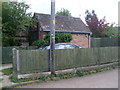
1
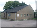
Bletchingdon Telephone Exchange, Oxon
Located off Station Road, this neat looking redbrick TE replaced the former TE in Station Road sometime during the 1970s, SP5017 refers http://www.geograph.org.uk/photo/2273033. Besides Bletchingdon, this TE also serves Kirtlington and Weston-on-the-Green nearby. The white BT notices can be seen to the left of the five windows. Its postcode is OX5 3DB.
Image: © David Hillas
Taken: 25 Sep 2010
0.09 miles
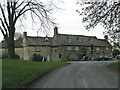
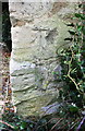
3
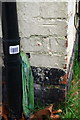
Benchmark on #7 Oxford Road
Ordnance Survey cut mark benchmark described on the Bench Mark Database at http://www.bench-marks.org.uk/bm92071
Image: © Roger Templeman
Taken: 9 Jan 2018
0.11 miles
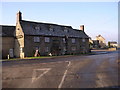
4
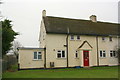
#7 Oxford Road
There is an OS benchmark Image on the left front corner, side face, of the house next to the black downpipe at the junction with the low extension
Image: © Roger Templeman
Taken: 9 Jan 2018
0.11 miles
7
Former Telephone Exchange, Bletchingdon
Situated in Station Road, this former TE was replaced by a larger building nearby sometime during the 1970s, SP5017 refers http://www.geograph.org.uk/photo/2273045. It would now appear to be in use as a back shed.
Image: © David Hillas
Taken: 25 Sep 2010
0.11 miles
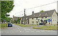
8
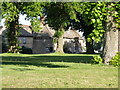
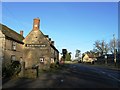
Blacks Head Inn at Bletchingdon
Viewed across the green.
Image: © Michael Trolove
Taken: 22 May 2010
0.12 miles
9
Benchmark on Blacks Head Inn
Ordnance Survey cut mark benchmark described on the Bench Mark Database at http://www.bench-marks.org.uk/bm92296
Image: © Roger Templeman
Taken: 9 Jan 2018
0.12 miles