IMAGES TAKEN NEAR TO
Watermead, KIDLINGTON, OX5 2XJ
Introduction
This page details the photographs taken nearby to Watermead, OX5 2XJ by members of the Geograph project.
The Geograph project started in 2005 with the aim of publishing, organising and preserving representative images for every square kilometre of Great Britain, Ireland and the Isle of Man.

There are currently over 7.5m images from over14,400 individuals and you can help contribute to the project by visiting https://www.geograph.org.uk
Image Map
Images are licensed for reuse under creativecommons.org/licenses/by-sa/2.0
Notes
- Clicking on the map will re-center to the selected point.
- The higher the marker number, the further away the image location is from the centre of the postcode.
Image Listing (11 Images Found)
Images are licensed for reuse under creativecommons.org/licenses/by-sa/2.0
Image
Details
Distance
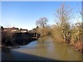
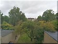
1
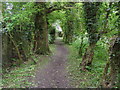
Oxford Green Belt Way
Oxford Green Belt Way path nearing Mill End
Image: © Shaun Ferguson
Taken: 19 May 2012
0.12 miles
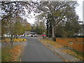
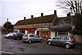
3
Cherwell Avenue, Kidlington
The Oxford Greenbelt Way is a circular footpath around the city of Oxford.
It lives up to its name in all but a few places.
There is a short roadside section along here to skirt around the north side of Kidlington.
Image: © Des Blenkinsopp
Taken: 19 Jan 2015
0.13 miles
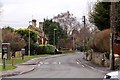
4
North end of Evans Lane, Kidlington
Looking towards the junction with Mill Street.
Image: © Richard Vince
Taken: 8 Nov 2016
0.14 miles
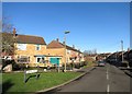
9
Kidlington village
Kidlington village, Waverley Avenue. Looking North West. September 2022.
Image: © Terrence Morgan
Taken: 8 Sep 2022
0.20 miles
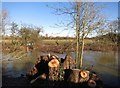
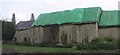
10
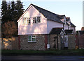
Old Toll House, Gosford
Toll House in the parish of Gosford and Water Eaton, Tollgate Cottage, Bicester Road, OX5 2PX.
Oxfordshire HER.
HER Number: 10177 https://www.heritagegateway.org.uk/Gateway/Results_Single.aspx?uid=MOX5255&resourceID=1033
Surveyed
Milestone Society National ID: OX.GOS
Image: © Alan Rosevear
Taken: Unknown
0.22 miles