1
Fairfax Road, Chalgrove
Fairfax Road is the main access road for the newer part of Chalgrove that is between the original village street and the by-pass.
Chalgrove was the site of a major Civil War battle and several roads here are named after leaders from that time. Sir Thomas Fairfax was commander of the Parliamentarian New Model Army. History on http://www.british-civil-wars.co.uk/biog/fairfax.htm
Image: © Des Blenkinsopp
Taken: 15 Jan 2013
0.05 miles
2
Off the High Street
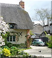
The Americans would love this bit of Shakespeare's Way. "Just darling" they might say.
Image: © Graham Horn
Taken: 4 May 2013
0.08 miles
3
Seventeenth century thatched cottages, Chalgrove High Street
See http://www.britishlistedbuildings.co.uk/en-248899-tudor-cottage-chalgrove-oxfordshire for entry in British Listed Buildings
Image: © Bikeboy
Taken: 18 Feb 2015
0.09 miles
4
High Street, Chalgrove
Chalgrove is a long village which looks as if it stagnated in the 18th and 19th centuries and so retained many older cottages. Development from the second half of the 20th century has been extensive and transformative but has left much of the High Street intact. The brook running the length of the village along the north side of the street adds to its personality.
Image: © Chris Brown
Taken: 22 Feb 2017
0.09 miles
5
153 High Street, Chalgrove
Timber-framed house, but apparently not of sufficient interest to justify listing.
Image: © Alan Murray-Rust
Taken: 9 Jul 2014
0.09 miles
6
110-114 High Street, Chalgrove
A range of 17th century cottages, all originally timber framed, but the nearest now with a roughcast front painted to resemble framing. Listed Grade II.
Image: © Alan Murray-Rust
Taken: 9 Jul 2014
0.09 miles
7
Brooklyn, High Street, Chalgrove
Timber framed 17th century farmhouse, the front remodelled in brick in the mid 19th century. Listed Grade II.
Image: © Alan Murray-Rust
Taken: 9 Jul 2014
0.10 miles
8
Off the High Street
Chalgrove is a fascinating place to walk through; newer properties interspersed with many thatched houses. This one also has a resident Morris Minor and a visiting duck sitting on the drive. We are walking Shakespeare's Way.
Image: © Graham Horn
Taken: 4 May 2013
0.11 miles
9
Stream at Berrick Road
This stream forms a storm drain the whole length of Chalgrove High Street. This is where it enters the village from the east, as seen from Shakespeare's Way.
Image: © Graham Horn
Taken: 4 May 2013
0.13 miles
10
Benchmark on stone bridge parapet, Monument Road
Ordnance Survey cut mark benchmark described on the Bench Mark Database at http://www.bench-marks.org.uk/bm56254
Image: © Roger Templeman
Taken: 4 Apr 2014
0.13 miles


