IMAGES TAKEN NEAR TO
Barns Close, OXFORD, OX33 1QB
Introduction
This page details the photographs taken nearby to Barns Close, OX33 1QB by members of the Geograph project.
The Geograph project started in 2005 with the aim of publishing, organising and preserving representative images for every square kilometre of Great Britain, Ireland and the Isle of Man.

There are currently over 7.5m images from over14,400 individuals and you can help contribute to the project by visiting https://www.geograph.org.uk
Image Map
Images are licensed for reuse under creativecommons.org/licenses/by-sa/2.0
Notes
- Clicking on the map will re-center to the selected point.
- The higher the marker number, the further away the image location is from the centre of the postcode.
Image Listing (18 Images Found)
Images are licensed for reuse under creativecommons.org/licenses/by-sa/2.0
Image
Details
Distance
1
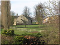
Back of Wheatley Park School
Looking across the fields from the bedroom of the B & B at the Old Farm House, where I stayed the night.
Image: © Chris Heaton
Taken: 11 Mar 2007
0.08 miles
2
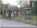
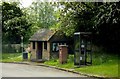
Bus stop, phone, post box, notices in Holton
The communications centre of the village.
Image: © David Hawgood
Taken: 20 Feb 2009
0.11 miles
4
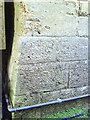
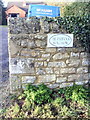
Benchmark on the old school house
Ordnance Survey cut mark benchmark described on the Bench Mark Database at http://www.bench-marks.org.uk/bm36500
Image: © Roger Templeman
Taken: 19 Jan 2011
0.13 miles
5
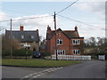
Old post office, Holton
The red brick building has a house name showing it used to be the post office. The road on the left is a cul-de-sac leading to farms.
Image: © David Hawgood
Taken: 20 Feb 2009
0.14 miles
6
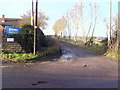
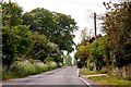
Public footpath to Forest Hill from Holton
Image: © Roger Templeman
Taken: 19 Jan 2011
0.18 miles
7
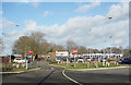
Sports Centre, Holton
Part of an extensive school and college campus between Holton and Wheatley.
Image: © Des Blenkinsopp
Taken: 17 Jan 2018
0.19 miles
8
Benchmark on wall at entrance to The Paddock Bungalow
Ordnance Survey cut mark benchmark described on the Bench Mark Database at http://www.bench-marks.org.uk/bm36501
Image: © Roger Templeman
Taken: 19 Jan 2011
0.19 miles
9
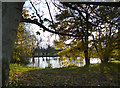
Holton Pond
A rather poor picture of this very secluded pond which is hidden away behind a fence and surrounded by trees.
Image: © Des Blenkinsopp
Taken: 7 Nov 2012
0.19 miles