IMAGES TAKEN NEAR TO
High Street, OXFORD, OX2 9QD
Introduction
This page details the photographs taken nearby to High Street, OX2 9QD by members of the Geograph project.
The Geograph project started in 2005 with the aim of publishing, organising and preserving representative images for every square kilometre of Great Britain, Ireland and the Isle of Man.

There are currently over 7.5m images from over14,400 individuals and you can help contribute to the project by visiting https://www.geograph.org.uk
Image Map
Images are licensed for reuse under creativecommons.org/licenses/by-sa/2.0
Notes
- Clicking on the map will re-center to the selected point.
- The higher the marker number, the further away the image location is from the centre of the postcode.
Image Listing (46 Images Found)
Images are licensed for reuse under creativecommons.org/licenses/by-sa/2.0
Image
Details
Distance
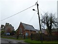
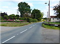
1
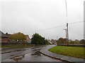
Looking from Leys Road into the High Street
Image: © Basher Eyre
Taken: 27 Oct 2020
0.04 miles
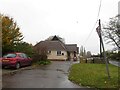
2
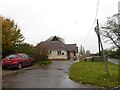
Cumnor Village Hall: late October 2020
At the junction of Leys Road with the High Street
Image: © Basher Eyre
Taken: 27 Oct 2020
0.04 miles
3
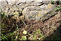
Benchmark on wall at B4017 / Leys Road junction
Ordnance Survey cut mark benchmark described on the Bench Mark Database at http://www.bench-marks.org.uk/bm70832
Image: © Roger Templeman
Taken: 9 Oct 2015
0.04 miles
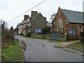
4
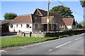
Cumnor Village Hall beside B4017 at the Leys Road junction
There is an OS benchmark Image on the angle of the hall's boundary wall
Image: © Roger Templeman
Taken: 9 Oct 2015
0.05 miles
6
Cumnor Village Hall: late October 2020
(on the corner of the B4017 and Leys Road)
Image: © Basher Eyre
Taken: 27 Oct 2020
0.05 miles
7
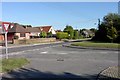
Junction in Cumnor
The junction of the B4017 (Cumnor High Street), coming from the left-hand side of the image, and Leys Road, coming from the right-hand side. The photo was taken just in front of the village hall, which is next to a Unitarian church.
Image: © Tom Pullman
Taken: 28 Aug 2005
0.06 miles
8
United Reformed Church
Cumnor United Reformed Church on Leys Road
Image: © Shaun Ferguson
Taken: 30 Dec 2009
0.06 miles
10
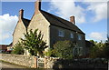
New Farm, Tumbledown Hill
There is an OS benchmark Image on the front of the house at its far corner
Image: © Roger Templeman
Taken: 9 Oct 2015
0.10 miles