IMAGES TAKEN NEAR TO
Davenant Road, OXFORD, OX2 8BX
Introduction
This page details the photographs taken nearby to Davenant Road, OX2 8BX by members of the Geograph project.
The Geograph project started in 2005 with the aim of publishing, organising and preserving representative images for every square kilometre of Great Britain, Ireland and the Isle of Man.

There are currently over 7.5m images from over14,400 individuals and you can help contribute to the project by visiting https://www.geograph.org.uk
Image Map
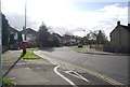
Images are licensed for reuse under creativecommons.org/licenses/by-sa/2.0
Notes
- Clicking on the map will re-center to the selected point.
- The higher the marker number, the further away the image location is from the centre of the postcode.
Image Listing (49 Images Found)
Images are licensed for reuse under creativecommons.org/licenses/by-sa/2.0
Image
Details
Distance
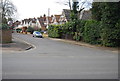
2
#54 Blandford Avenue
There is an OS benchmark Image on the left hand side of the house at its front corner
Image: © Roger Templeman
Taken: 27 Apr 2016
0.07 miles
3
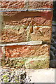
Benchmark on #54 Blandford Avenue
Ordnance Survey cut mark benchmark described on the Bench Mark Database at http://www.bench-marks.org.uk/bm75136
Image: © Roger Templeman
Taken: 27 Apr 2016
0.07 miles
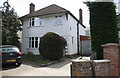
5
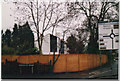
Modern house on the corner of Davenant Road and Banbury Road
This was as close as I could get to it, there wasn't any clue how to see it without the fence in the way. The road sign has since been replaced with totally different places on it (although of course the roads point to the same ones). That is decided by the council's own priorities.
Image: © David Howard
Taken: Unknown
0.08 miles
6
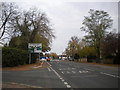
A40 Oxford Ring Road - Sunderland Avenue
This is the only section of Oxford's ring road which is not a dual carriageway. As with most of north Oxford suburbia, there is plenty of greenery.
Image: © Peter Whatley
Taken: 12 Apr 2011
0.09 miles
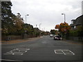
7
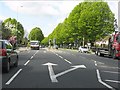
Banbury Road approaching Cutteslowe Roundabout
Seen from the end of Davenant Road.
Image: © Richard Vince
Taken: 8 Nov 2016
0.09 miles
9
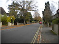
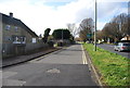
Davenant Road, Cutteslowe (2)
A residential road between Woodstock and Banbury Roads.
Image: © Richard Vince
Taken: 8 Nov 2016
0.10 miles
10
West end of Carlton Road, Cutteslowe
A residential road off Banbury Road.
Image: © Richard Vince
Taken: 8 Nov 2016
0.10 miles