IMAGES TAKEN NEAR TO
South Lawn, WITNEY, OX28 5HX
Introduction
This page details the photographs taken nearby to South Lawn, OX28 5HX by members of the Geograph project.
The Geograph project started in 2005 with the aim of publishing, organising and preserving representative images for every square kilometre of Great Britain, Ireland and the Isle of Man.

There are currently over 7.5m images from over14,400 individuals and you can help contribute to the project by visiting https://www.geograph.org.uk
Image Map (Loading...)


Getting Data...Please wait
Leaflet Map data © OpenStreetMap
Images are licensed for reuse under creativecommons.org/licenses/by-sa/2.0
Notes
- Clicking on the map will re-center to the selected point.
- The higher the marker number, the further away the image location is from the centre of the postcode.
Image Listing (10 Images Found)
Images are licensed for reuse under creativecommons.org/licenses/by-sa/2.0
Image
Details
Distance
2
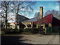
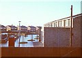
Queen Emma's primary school, Witney
Built in 1970 to an open-plan design of interlocking blocks by the county architect Albert Smith, to all appearances it is wearing its years well.
Image: © Chris Brown
Taken: 12 Feb 2018
0.09 miles
3
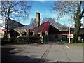
Queen Emma's primary school, Witney
Built in 1970 to an open-plan design of interlocking blocks by the county architect Albert Smith, to all appearances it is wearing its years well.
Image: © Chris Brown
Taken: 12 Feb 2018
0.10 miles
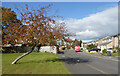
4
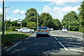
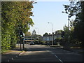
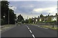
A415 Ducklington Lane, Witney
Burwell Drive to the left.
Image: © Robin Webster
Taken: 22 Aug 2020
0.17 miles
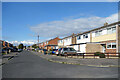
5
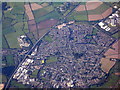
Witney
Looking west over the huge Burwell Farm Estate from close to the A415 road
Image: © Brendan and Ruth McCartney
Taken: Unknown
0.17 miles
8
Witney from above Long Hanborough
Looking southwest. The A40 skirts the town from lower-left to mid-top.
Image: © M J Richardson
Taken: 26 Sep 2015
0.22 miles
9
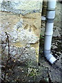
Benchmark on #20 Ducklington Lane
Ordnance Survey cut mark benchmark described on the Bench Mark Database at http://www.bench-marks.org.uk/bm37250
Image: © Roger Templeman
Taken: 5 Mar 2011
0.22 miles