IMAGES TAKEN NEAR TO
Caversfield, BICESTER, OX27 8RE
Introduction
This page details the photographs taken nearby to OX27 8RE by members of the Geograph project.
The Geograph project started in 2005 with the aim of publishing, organising and preserving representative images for every square kilometre of Great Britain, Ireland and the Isle of Man.

There are currently over 7.5m images from over14,400 individuals and you can help contribute to the project by visiting https://www.geograph.org.uk
Image Map
Images are licensed for reuse under creativecommons.org/licenses/by-sa/2.0
Notes
- Clicking on the map will re-center to the selected point.
- The higher the marker number, the further away the image location is from the centre of the postcode.
Image Listing (11 Images Found)
Images are licensed for reuse under creativecommons.org/licenses/by-sa/2.0
Image
Details
Distance
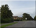
1

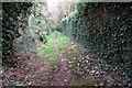
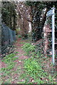
Path heading towards Springfield Road
From the A4421 the path heading towards Springfield Road
Image: © Shaun Ferguson
Taken: 17 Jul 2020
0.04 miles
4
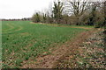
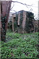
Path round the field edge
Not marked as such but clearly used by the locals
Image: © Philip Jeffrey
Taken: 10 Apr 2016
0.11 miles
9
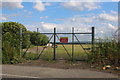
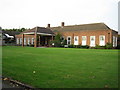
The new back entrance to RAF Bicester airfield
It was moved from further along the road a year or two ago.
Image: © David Howard
Taken: 8 Jun 2019
0.23 miles
10
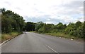
Turning off A4421 for housing estates at Caversfield
Image: © David Smith
Taken: 24 Aug 2017
0.23 miles