IMAGES TAKEN NEAR TO
Goldcrest Way, BICESTER, OX26 6XL
Introduction
This page details the photographs taken nearby to Goldcrest Way, OX26 6XL by members of the Geograph project.
The Geograph project started in 2005 with the aim of publishing, organising and preserving representative images for every square kilometre of Great Britain, Ireland and the Isle of Man.

There are currently over 7.5m images from over14,400 individuals and you can help contribute to the project by visiting https://www.geograph.org.uk
Image Map
Images are licensed for reuse under creativecommons.org/licenses/by-sa/2.0
Notes
- Clicking on the map will re-center to the selected point.
- The higher the marker number, the further away the image location is from the centre of the postcode.
Image Listing (17 Images Found)
Images are licensed for reuse under creativecommons.org/licenses/by-sa/2.0
Image
Details
Distance
4
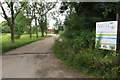
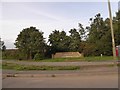
Bicester Footpath off London Road
Image: © Malcolm Sandilands
Taken: 16 Jun 2010
0.16 miles
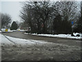
5
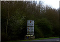
Modern sign for Langford Village
The new Langford Village is a large development with its own school and shopping centre
Image: © David Smith
Taken: 24 Aug 2017
0.17 miles
6
Bicester and the DSDC
The Defence Storage and Distribution Centre at Bicester which, according to the map, looks like a full sized and extensive train set.
Image: © M J Richardson
Taken: 5 Sep 2013
0.19 miles
7
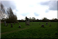
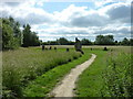
Stone circle, Bicester
Nothing on the map about an ancient monument so I suspect this is something quite recent although I was not able to find out any more information about it.
Image: © Robert Eva
Taken: 23 Mar 2017
0.19 miles
8
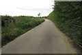
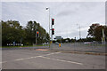
Gravenhill North Road junction with A41
First roundabout on entering Bicester on westbound A41
Image: © John Firth
Taken: 28 Dec 2010
0.19 miles
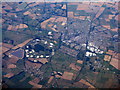
10
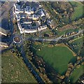
Aerial view of SP5821
Mallards Way, Parkland Place, Wren Way and the Stone Circle can all be seen in this photo of the roundabout on the B4100. (Courtesy John Broad, LVCA http://www.langfordlife.org.uk )
Image: © Steve Newman
Taken: 17 Nov 2005
0.21 miles