IMAGES TAKEN NEAR TO
West End, BICESTER, OX26 5DG
Introduction
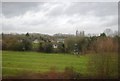
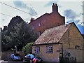
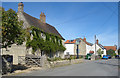
This page details the photographs taken nearby to West End, OX26 5DG by members of the Geograph project.
The Geograph project started in 2005 with the aim of publishing, organising and preserving representative images for every square kilometre of Great Britain, Ireland and the Isle of Man.

There are currently over 7.5m images from over14,400 individuals and you can help contribute to the project by visiting https://www.geograph.org.uk
Image Map
Images are licensed for reuse under creativecommons.org/licenses/by-sa/2.0
Notes
- Clicking on the map will re-center to the selected point.
- The higher the marker number, the further away the image location is from the centre of the postcode.
Image Listing (24 Images Found)
Images are licensed for reuse under creativecommons.org/licenses/by-sa/2.0
Image
Details
Distance
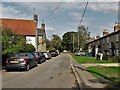
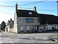
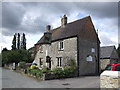
2
The Black Bull, Launton
Launton has two pubs. This one is The Black Bull, the other is just The Bull, colour not specified.
Image: © Des Blenkinsopp
Taken: 14 Sep 2019
0.01 miles
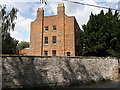
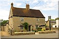
3
The Black Bull, Launton
Draught Bass served alongside other beers. Old Halls Brewery sign attached to post.
Image: © al partington
Taken: 11 Aug 2006
0.04 miles