IMAGES TAKEN NEAR TO
Ernicote Close, BICESTER, OX25 2LG
Introduction
This page details the photographs taken nearby to Ernicote Close, OX25 2LG by members of the Geograph project.
The Geograph project started in 2005 with the aim of publishing, organising and preserving representative images for every square kilometre of Great Britain, Ireland and the Isle of Man.

There are currently over 7.5m images from over14,400 individuals and you can help contribute to the project by visiting https://www.geograph.org.uk
Image Map
Images are licensed for reuse under creativecommons.org/licenses/by-sa/2.0
Notes
- Clicking on the map will re-center to the selected point.
- The higher the marker number, the further away the image location is from the centre of the postcode.
Image Listing (9 Images Found)
Images are licensed for reuse under creativecommons.org/licenses/by-sa/2.0
Image
Details
Distance
3
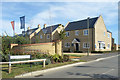
Church Leys Field
A new housing development on the edge of Ambrosden.
Image: © Des Blenkinsopp
Taken: 14 Sep 2019
0.17 miles
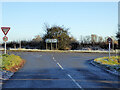
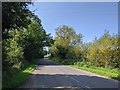
4
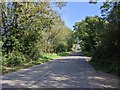
Road from Ambrosden heading towards the B4011
Image: © Rob Purvis
Taken: 14 Sep 2020
0.19 miles
5

The Corner of Bluebell Road
Another picture on the new estate under construction between Ambrosden and Blackthorn.
Image: © Des Blenkinsopp
Taken: 14 Sep 2019
0.21 miles
6

House Building, Ambrosden
New houses on a greenfield site between Ambrosden and Blackthorn.
Image: © Des Blenkinsopp
Taken: 14 Sep 2019
0.23 miles
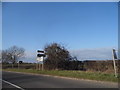
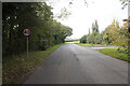
8
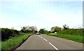
The B4011 to Bicester
The B4011 runs from Thame to Bicester.
Image: © Steve Daniels
Taken: 4 May 2014
0.24 miles